Atlantic Beach in Carteret County, North Carolina — The American South (South Atlantic)
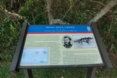
Hoop Pole Creek
Ferrying Troops and Equipment at High Tide
— Burnside Expedition —
In March 1862, Union Gen. John G. Parke’s brigade of Gen. Ambrose E. Burnside’ Coastal Division advanced from New Bern to capture Beaufort Harbor and Fort Macon. During March 22-26, Parke’s forces took possession of Carolina City, Morehead City and Beaufort. Fort Macon’s Confederate garrison refused to surrender, forcing Parke to begin siege operations against the fort.
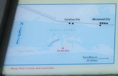
On March 29, a detachment of the 4th Rhode Island Infantry crossed Bogue Sound from Carolina City and established an outpost camp on Bogue Banks here at Hoop Pole Creek, five miles from Fort Macon. This camp became the base from which Parke conducted the siege. Over the next two weeks a total of 22 companies of Union infantry and artillery crossed over to the camp from Carolina City. Three batteries of siege cannons and mortars and their ammunition were also ferried across the sound to the camp, using old barges, scows and one light-draft stern-wheel steamer. Bogue Sound and Hoop Pole Creek were so shallow that Parke could only ferry over his troops and equipment at high tide.
Once unloaded from the vessels, the heavy artillery had to be manhandled through the muddy salt marsh and sand to reach the camp. From Hoop Pole Creek, the artillery was then dragged almost four miles up the beach and set up in artillery emplacements from which to fire on Fort Macon. On April 25, Parke’s forces bombarded Fort Macon for eleven hours, forcing the Confederates to surrender the following day.
(captions)
(lower left) Hoop Pole Creek and environs.
(upper right) Gen. John G. Parke; Moving cannon through the marsh. - Sketch courtesy Brian Kraus
Erected by North Carolina Civil War Trails.
Topics and series. This historical marker is listed in these topic lists: Forts and Castles • War, US Civil • Waterways & Vessels. In addition, it is included in the North Carolina Civil War Trails series list. A significant historical month for this entry is March 1862.
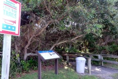
Location. 34° 42.091′ N, 76° 45.111′ W. Marker is in Atlantic Beach, North Carolina, in Carteret County. Marker can be reached from the intersection of West Fort Macon Road and Atlantic Station Shopping Center, on the right when traveling west. The marker is located on the east side of the Atlantic Station Shopping Center parking lot. Touch for map. Marker is at or near this postal address: 916 W Fort Macon Rd, Atlantic Beach NC 28512, United States of America. Touch for directions.
Other nearby markers. At least 8 other markers are within 2 miles of this marker, measured as the crow flies. Hoop Pole Creek: A Coastal Nature Preserve (here, next to this marker); Hoophole Creek (approx. 0.6 miles away); World Trade Center (approx. 0.7 miles away); Atlantic Intracoastal Waterway (approx. 1.4 miles away); Carolina City (approx. 1˝ miles away); Camp Glenn (approx. 1.6 miles away); Siege of Fort Macon (approx. 1.6 miles away); A United States Naval Section Base Inshore Patrol (approx. 1.6 miles away). Touch for a list and map of all markers in Atlantic Beach.
Credits. This page was last revised on June 16, 2016. It was originally submitted on September 11, 2014, by Don Morfe of Baltimore, Maryland. This page has been viewed 718 times since then and 47 times this year. Photos: 1, 2, 3, 4. submitted on September 11, 2014, by Don Morfe of Baltimore, Maryland. • Bernard Fisher was the editor who published this page.


