Spicer in Kandiyohi County, Minnesota — The American Midwest (Upper Plains)
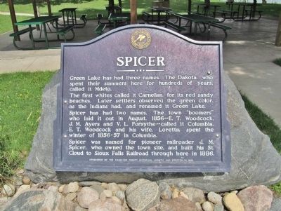
Spicer
The first whites called it Carnelian, for its red sandy beaches. Later settlers observed the green color, as the Indians had, and renamed it Green Lake.
Spicer has had two names. The town "boomers" who laid it out in August, 1856 – E. T. Woodcock, J. M. Ayers and V. L. Forsythe – called it Columbia. E. T. Woodcock and his wife, Loretta, spent the winter of 1856-57 in Columbia.
Spicer was named for pioneer railroader J. M. Spicer, who owned the town site, and built his St. Cloud to Sioux Falls Railroad through here in 1886.
Erected 1990 by the Kandiyohi County Historical Society.
Topics. This historical marker is listed in these topic lists: Native Americans • Railroads & Streetcars • Settlements & Settlers • Waterways & Vessels. A significant historical year for this entry is 1856.
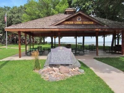
Location. 45° 14.175′ N, 94° 56.314′ W. Marker is in Spicer, Minnesota, in Kandiyohi County. Marker is on Lake Avenue North (County Highway 30) north of Manitoba Street (County Highway 58), on the right when traveling north. Marker is at Downtown City Park / Lions Park. Touch for map. Marker is at or near this postal address: 159 Lake Avenue North, Spicer MN 56288, United States of America. Touch for directions.
Other nearby markers. At least 8 other markers are within 4 miles of this marker, measured as the crow flies. Veterans Memorial (within shouting distance of this marker); Little Crow's Camp (approx. 1.7 miles away); Green Lake Village and Mill (approx. 1.9 miles away); Olof Olson Haugen (approx. 2˝ miles away); Victory Dance (approx. 2.6 miles away); First Missionary (approx. 3.3 miles away); Green Lake Mounds (approx. 3.8 miles away); Indian Camp (approx. 4 miles away). Touch for a list and map of all markers in Spicer.
More about this marker. The marker has the Historic Site seal of the Kandiyohi County Historical Society · 1895.
Also see . . . John Mason Spicer. Find A Grave. (Submitted on October 8, 2014.)
Credits. This page was last revised on November 21, 2021. It was originally submitted on October 8, 2014, by Keith L of Wisconsin Rapids, Wisconsin. This page has been viewed 801 times since then and 55 times this year. Photos: 1, 2. submitted on October 8, 2014, by Keith L of Wisconsin Rapids, Wisconsin.

