Spiro in Le Flore County, Oklahoma — The American South (West South Central)
Skullyville
Choctaw National Cemetery
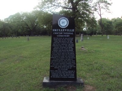
(front)
The founding of Skullyville dates back to 1832 when the removal of the Choctaws was in full progress. The old cemetery has all the interest usually attached to these places. Early on our people used rocks and stones to mark their loved ones grave sites. Though most of the rocks & stones that were not engraved in some way have been removed, it is known that hundreds of Indian people lie here in unmarked graves. The stones that are left with engraving date back to the early eighteen thirties. It is a peaceful spot where numerous trees cast their shade over the final resting place of many of our ancestors.
May 2, 1998 Miko (Chief) Gregory E. Pyle unveiled this monument to symbolize that the Skullyville Cemetery is the Choctaw Nation of Oklahoma's National Cemetery.
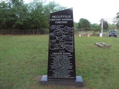
(rear)
Original 3 Districts
• National Capital
• District Capital
• County Court
Choctaw Nation
Monument was placed as a tribal historical marker by the efforts of the following administrative personnel. Gregory E. Pyle, Chief Mike Bailey, Assistant Chief Tribal Council Members: Charley Jones, Billy Paul Baker, Leslie James, Lois Burton, Charlotte Jackson, Randle Durant, Glenn Johnson, Perry Thompson, Ted Dosh, E.J. Johnson, Bob Pate, and James Frazier. Nancy Belvin, Special Projects Coordinator. Choctaw Nation consists or 12 districts of which all Choctaw Nation of Ok. members are affiliated with. Tribal Council members and Chief are elected by tribal members.
Erected 1998 by Choctaw Nation of Oklahoma.
Topics. This historical marker is listed in these topic lists: Cemeteries & Burial Sites • Native Americans • Settlements & Settlers. A significant historical month for this entry is May 1932.
Location. 35° 15.037′ N, 94° 35.615′ W. Marker is in Spiro, Oklahoma, in Le Flore County. Marker can be reached from Spring Road, 0.2 miles north of Lake View Drive (County Route 22A), on the left when traveling north. Marker is located within the Choctaw National Cemetery / Skullyville Cemetery. Touch for map. Marker is in this post office area: Spiro OK 74959, United States of America. Touch for directions.
Other nearby markers. At least 8 other markers are within 13 miles of this marker, measured as the crow flies. A different marker also named Skullyville (about 400 feet away, measured in a direct line); Fort Coffee (approx. 0.7 miles away); Choctaw Agency (approx. 0.7 miles away); Battle of Backbone Mountain (approx. 6.7 miles away); Reynolds Castle (approx. 8 miles away); Chief Mosholatubbee (approx. 12 miles away); Defending Fort Smith (approx. 13.1 miles away in Arkansas); Osage Nation (approx. 13.1 miles away in Arkansas). Touch for a list and map of all markers in Spiro.
Credits. This page was last revised on June 16, 2016. It was originally submitted on October 12, 2014, by Michael Manning of Woodlawn, Tennessee. This page has been viewed 905 times since then and 77 times this year. Photos: 1, 2. submitted on October 12, 2014, by Michael Manning of Woodlawn, Tennessee. • Bernard Fisher was the editor who published this page.

