Near Pocola in Le Flore County, Oklahoma — The American South (West South Central)
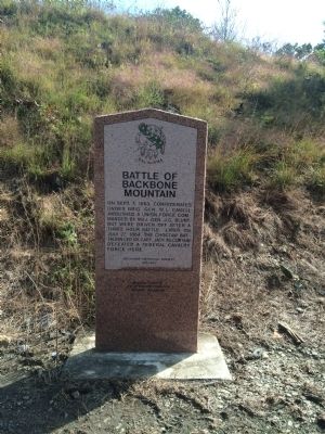
Battle of Backbone Mountain
On Sept. 1, 1863 Confederates under Brig. Gen. W.L. Cabell ambushed a Union force commanded by Maj. Gen. J.G. Blunt, but were driven off after a three hour battle. Later on July 24, 1864, the Choctaw Battalion led by Capt. Jack McCurtain defeated a Federal cavalry force here.
Erected 1995 by Oklahoma Historical Society. (Marker Number 190.)
Topics and series. This historical marker is listed in these topic lists: Native Americans • War, US Civil. In addition, it is included in the Oklahoma Historical Society series list. A significant historical month for this entry is July 1861.
Location. 35° 12.164′ N, 94° 29.476′ W. Marker is near Pocola, Oklahoma, in Le Flore County. Marker is at the intersection of State Highway 112 and Hardin Lane, on the right when traveling north on State Highway 112. Touch for map. Marker is in this post office area: Pocola OK 74902, United States of America. Touch for directions.
Other nearby markers. At least 8 other markers are within 13 miles of this marker, measured as the crow flies. Reynolds Castle (approx. 3.7 miles away); Fort Coffee (approx. 6.4 miles away); Choctaw Agency (approx. 6.4 miles away); Skullyville (approx. 6.6 miles away); a different marker also named Skullyville (approx. 6.7 miles away); Chief Mosholatubbee (approx. 7˝ miles away); Battle of Massard Prairie (approx. 9.7 miles away in Arkansas); William O. Darby (approx. 13 miles away in Arkansas).
Regarding Battle of Backbone Mountain. The actual battlefield for the September 1, 1863 battle was six miles east along the Devil's Backbone in Arkansas. There is little documentation of the July 24, 1864 battle.
Credits. This page was last revised on June 16, 2016. It was originally submitted on October 13, 2014, by Michael Manning of Woodlawn, Tennessee. This page has been viewed 1,223 times since then and 101 times this year. Photo 1. submitted on October 13, 2014, by Michael Manning of Woodlawn, Tennessee. • Bernard Fisher was the editor who published this page.
Editor’s want-list for this marker. A photo of the marker and the surrounding area in context. • A clear, close-up photo of the marker. • Can you help?
