Williamsburg, Virginia — The American South (Mid-Atlantic)
Defending the Peninsula
Avenue of Attack
— 1862 Peninsula Campaign —
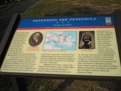
Late in April, Lt. Col. Benjamin S. Ewell, an 1832 West Point graduate and former president of the College of William and Mary, took command of Confederate forces on the Peninsula. Although Ewell conceived a fortified line near Williamsburg, it was Gen. John B. Magruder who constructed a defensive system in depth across the Peninsula in 1861-1862. An 1830 West Point graduate dubbed Prince John for his theatrical mannerisms, Magruder enlisted the assistance of Capt. Alfred Rives, Acting Chief of the Engineering Bureau in Richmond.
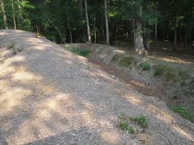
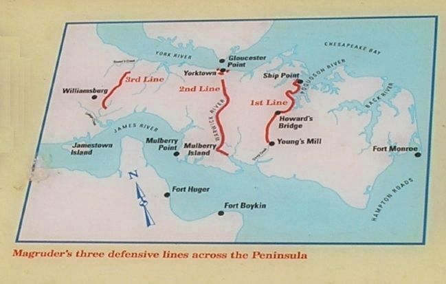
Magruder’s forward line – closest to the Federals at Fort Monroe – began at Young’s Mill on Deep Creek, crossed the Peninsula to Howard’s Bridge on the Poquoson River, and followed that river to Ship Point. The second line began at Mulberry Island on the James River and followed the Warwick River to within a mile and a half of Yorktown, which was fortified with a series of redoubts, some constructed atop British works remaining from the 1781 siege. The final line, the Williamsburg Line, consisted of 14 redoubts between College and Queen’s creeks. Powerful water batteries, including one at Gloucester Point across the York River from Yorktown, defended the system’s flanks. Others covered the James River, including Mulberry Island Point, Fort Boykin at Burwell’s Bay, Fort Huger on Hardin’s Bluff, and Jamestown Island.
Erected by Virginia Civil War Trails.
Topics and series. This historical marker is listed in these topic lists: Notable Places • War, US Civil. In addition, it is included in the Virginia Civil War Trails series list. A significant historical month for this entry is April 1827.
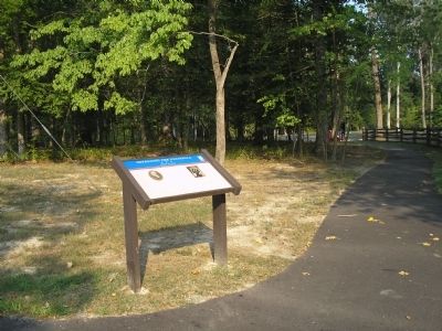
Location. 37° 15.293′ N, 76° 41.134′ W. Marker is in Williamsburg, Virginia. Marker is on Quarterpath Road, on the left when traveling south. Marker is located in Redoubt Park on Quarterpath Road in Williamsburg. Touch for map. Marker is in this post office area: Williamsburg VA 23185, United States of America. Touch for directions.
Other nearby markers. At least 8 other markers are within walking distance of this marker. Williamsburg in the Civil War (within shouting distance of this marker); Redoubt 1 (within shouting distance of this marker); Quarterpath Road (about 300 feet away, measured in a direct line); Battle of Williamsburg (about 400 feet away); a different marker also named Battle of Williamsburg (approx. ¼ mile away); Redoubt 2 (approx. ¼ mile away); History of Fort Magruder (approx. 0.7 miles away); a different marker also named The Battle of Williamsburg (approx. ¾ mile away). Touch for a list and map of all markers in Williamsburg.
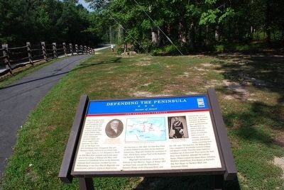
More about this marker. The top of the marker contains a map of Magruder’s three defensive lines across the Peninsula. Flanking the map are photographs of Gen. John B. Magruder, Courtesy of Library of Congress and Lt. Col. Benjamin S. Ewell, Courtesy of the Special Collections Research Center, Earl Gregg Swem Library, College of William and Mary.
Related markers. Click here for a list of markers that are related to this marker. Markers on the walking trail of Williamsburg’s Redoubt Park.
Also see . . .
1. Battle of Williamsburg, 5 May 1862. Williamsburg was the first large battlefield encounter between Union and Confederate forces during the Peninsula Campaign of 1862. (Submitted on August 19, 2008, by Bill Coughlin of Woodland Park, New Jersey.)
2. The Peninsula Campaign of 1862. (Submitted on August 19, 2008, by Bill Coughlin of Woodland Park, New Jersey.)
3. Tidewater Virginia, The 1862 Peninsula Campaign.
Civil War Traveler. (Submitted on August 19, 2008, by Bill Coughlin of Woodland Park, New Jersey.)
Credits. This page was last revised on June 16, 2016. It was originally submitted on August 19, 2008, by Bill Coughlin of Woodland Park, New Jersey. This page has been viewed 2,011 times since then and 51 times this year. Last updated on October 15, 2014, by Peter Jones of Williamsburg, VA - Virginia. Photos: 1, 2. submitted on August 19, 2008, by Bill Coughlin of Woodland Park, New Jersey. 3. submitted on August 8, 2015, by Brandon Fletcher of Chattanooga, Tennessee. 4, 5, 6. submitted on August 19, 2008, by Bill Coughlin of Woodland Park, New Jersey. • Bill Pfingsten was the editor who published this page.
