Miami in Miami-Dade County, Florida — The American South (South Atlantic)
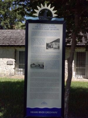
Fort Dallas and the William F. English Plantation Slave Quarters
Miami River Greenway
Inscription.
The United States of America took possession of Florida from Spain under the terms of the 1821 Treaty of Paris. In 1830, the U.S. implemented the Indian Removal Act, forcing Seminole Indians south into the Miami and Everglades area. The Second Seminole War erupted in 1835 and was marked by the killing of Miami-Dade County's namesake, Major Francis Longhorn Dade. During the war, settlers attempted to take Seminole Lands, relocate Seminoles west of the Mississippi River and reclaim runaway slaves.
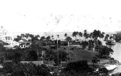
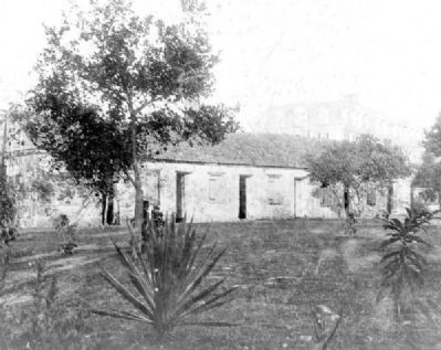
Construction of the first three wooden buildings in Fort Dallas, named after U.S. Navy Officer Commodore Alexander James Dallas, commenced in 1838 on plantation land leased from Richard Fitzpatrick near the mouth of the Miami River's north shore. When the Second Seminole War ended in 1842, Fitzpatrick sold the land to his nephew, William F. English.
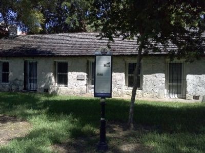
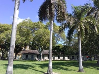
Starting in 1842, English reconstructed the plantation and added new buildings to the complex, which included the construction of the ollitic limerock slave quarters before you today in Lummus Park. After English left for the California Gold Rush in 1849, the Army requisitioned Fort Dallas on the English property. The Army renovated the building, adding a second wooden floor for soldier barracks on top of the remaining rock structure, which was also used as a storehouse.
Following the end of the Third Seminole War (1855-1858) the Fort Dallas area became central to Miami's settlement. Subsequent uses of the building have included a trading post, the county courthouse, and the Miami post office. In 1923, the building was transformed into a restaurant, known as the "Fort Dallas Tea Room," and in 1925, Dr. R.C. Hogue purchased the Fort Dallas area to construct the Robert Clay Hotel.
In 1925, in an effort to preserve this historic structure, the Miami City Commission provided a site for its relocated in today's Lummus Park, Miami's first designated park, originally called "City Park." Lummus Park is named after former Miami Mayor (1900-1903) John "J.E." Lummus. The Fort Dalls "long building" was disassembled stone-by-stone, barged up the Miami River, and rebuilt in City Park by the Miami Women's Club and the Everglades Chapter of the Daughters of the American Reolution (DAR). Reconstruction was completed in September 1929, and the Miami City Commission designated it a historic site in 1984.
(captions)
(right) Fort Dallas, circa 1880's. Florida Memory Project
(left) "Long Building" at its Original Location, 1909. Hugh C. Leighton Company
Erected by The Villagers and the Miami River Greenway.
Topics. This historical marker is listed in these topic lists: African Americans
• Forts and Castles • Native Americans • Wars, US Indian. A significant historical month for this entry is September 1929.
Location. 25° 46.587′ N, 80° 12.117′ W. Marker is in Miami, Florida, in Miami-Dade County. Marker can be reached from the intersection of Northwest North River Drive and Northwest 3rd Street, on the right when traveling north. Marker is located inside Lummus Park. Touch for map. Marker is at or near this postal address: 404 NW 3rd Street, Miami FL 33128, United States of America. Touch for directions.
Other nearby markers. At least 8 other markers are within walking distance of this marker. Wagner Homestead (within shouting distance of this marker); Lummus Park Historic District (about 600 feet away, measured in a direct line); South River Drive Historic District Boarding Houses (approx. ¼ mile away); Miami River Historic Working Riverfront (approx. ¼ mile away); Dade County (approx. half a mile away); The Historic Negro Police Precinct & Courthouse Museum: The First Five (approx. half a mile away); Judge Lawson Edward Thomas Law Office (approx. 0.6 miles away); Gesu Catholic Church (approx. 0.6 miles away). Touch for a list and map of all markers in Miami.
Regarding Fort Dallas and the William F. English Plantation Slave Quarters.
Fort Dallas and the English plantation slave quarters are part of the Lummus Park Historic District, Northwest Fifth Street to the north, Flagler Street to the south, Northwest Third Avenue to the east, and the Miami River to the west.Lummus Park was added to the National Register of Historic Places in 2006. It has some of the oldest buildings in Miami.
Credits. This page was last revised on June 16, 2016. It was originally submitted on October 19, 2014, by Marsha A. Matson of Palmetto Bay, Florida. This page has been viewed 3,599 times since then and 525 times this year. Photos: 1, 2, 3, 4, 5, 6. submitted on October 19, 2014, by Marsha A. Matson of Palmetto Bay, Florida. • Bernard Fisher was the editor who published this page.
