Littlefield in Mohave County, Arizona — The American Mountains (Southwest)
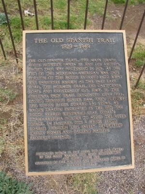
The Old Spanish Trail
1829 - 1848
The Old Spanish Trail, the main trade route between Santa Fe and Los Angeles, passed this way beginning in 1829. At the end of the Mexican-American War this portion of the route evolved into what was variously known as the Salt Lake Road, the Mormon Trail, the California Road, and eventually U.S. Hwy. 91. The original pack trail descended Utah Hill, passed through Beaver Dam, then followed the Virgin River toward Las Vegas. As wagon traffic increased in the 1850s the route veered westward near today's Utah-Arizona border to avoid the river gorge. In January 2005, a major flood roared through this valley, destroying thirty homes and causing massive property damage.
Erected 2005 by E Clampus Vitus. (Marker Number 121.)
Topics and series. This historical marker is listed in these topic lists: Exploration • Hispanic Americans • Notable Events • Roads & Vehicles. In addition, it is included in the California Trail, the E Clampus Vitus, and the Old Spanish National Trail series lists. A significant historical month for this entry is January 2005.
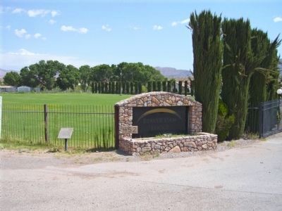
Location. 36° 53.921′ N, 113° 56.071′ W. Marker is in Littlefield, Arizona, in Mohave County. Marker is at the intersection of County Highway 91 and Old Pioneer Road on County Highway 91. Touch for map. Marker is in this post office area: Littlefield AZ 86432, United States of America. Touch for directions.
Other nearby markers. At least 8 other markers are within 10 miles of this marker, measured as the crow flies. Charles Arthur Hughes Home (approx. 9.6 miles away in Nevada); Abram Woodbury Home and Gas Station (approx. 9.7 miles away in Nevada); Drug Store / Bakery (approx. 9.7 miles away in Nevada); Ervin "Casey" Jones House (approx. 9.7 miles away in Nevada); Charles Hardy Home (approx. 9.7 miles away in Nevada); John David Pulsipher Home (approx. 9.7 miles away in Nevada); William Abbott Home / Abbott Hotel (approx. 9.7 miles away in Nevada); Rock House (approx. 9.7 miles away in Nevada).
Also see . . .
1. Old Spanish Trail. Wikipedia article (Submitted on September 25, 2009.)
2. E Clampus Vitus. Wikipedia entry (Submitted on September 25, 2009.)
3. Old Spanish Trail Association. Association website homepage (Submitted on September 25, 2009.)
Additional keywords. Old Spanish Trail
Credits. This page was last revised on November 20, 2021. It was originally submitted on September 25, 2009. This page has been viewed 3,581 times since then and 66 times this year. Last updated on November 3, 2014. Photos: 1. submitted on September 25, 2009. 2. submitted on August 31, 2011, by Bill Kirchner of Tucson, Arizona. • Bill Pfingsten was the editor who published this page.

