Towson in Baltimore County, Maryland — The American Northeast (Mid-Atlantic)
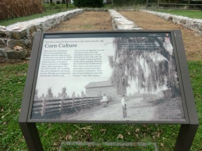
Corn Culture
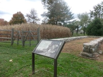
Mule Barn, constructed 1855, Corncrib, ca. 1845, destroyed by fire, 1989
— Hampton National Historic Site, National Park Service, U.S. Department of the Interior —
You can tell how large the corncrib was based on the size of the foundation before you---it held thousands of ears. Once dry, the corn would be shelled and taken to the mill for grinding. Plowing the cornfields was backbreaking labor. Slaves and tenant farmers used mules, housed in the barn seen nearby, to pull plows. These sure-footed workhorses were the “tractors” of the 19th century.
Corn is justly regarded as the national crop of the United States. Its money value is double that of hay, threefold that of wheat, and fourfold that of cotton.
Report, Commissioner of Agriculture, Washington, 1862.
[Caption:]
A view of the corncrib and corn shocks from the Farm Road, ca. 1897. The mule barn and corncrib were located near the cornfields to make planting, harvesting, and processing easier. At harvest time, slaves from nearby plantations came to help husk corn and haul ears to the crib. Husking parties were festive events, with competitions, music, and storytelling.
Erected by National Park Service, U.S. Department of the Interior.
Topics. This historical marker is listed in these topic lists: African Americans • Agriculture • Colonial Era • Horticulture & Forestry • Settlements & Settlers. A significant historical year for this entry is 1855.
Location. 39° 25.236′ N, 76° 35.232′ W. Marker is in Towson, Maryland, in Baltimore County. Marker can be reached from Hampton Lane, 0.1 miles west of Stone Barn Road, on the right when traveling west. Touch for map. Marker is at or near this postal address: 535 Hampton Lane, Towson MD 21286, United States of America. Touch for directions.
Other nearby markers. At least 8 other markers are within walking distance of this marker. Hampton: An American Story (within shouting distance of this marker); The View from Below (within shouting distance of this marker); The Lower House (within shouting distance of this marker); A Slave Village (about 300 feet away, measured in a direct line); Quarters #2 & 3 (about 300 feet away); The Cream of Hampton (about 400 feet away); Thoroughbreds at Hampton (approx. 0.2 miles away); a different marker also named Hampton: An American Story (approx. ¼ mile away). Touch for a list and map of all markers in Towson.
Credits. This page was last revised on January 2, 2020. It was originally submitted on November 4, 2014, by Don Morfe of Baltimore, Maryland. This page has been viewed 568 times since then and 14 times this year. Photos: 1, 2. submitted on November 4, 2014, by Don Morfe of Baltimore, Maryland. • Bill Pfingsten was the editor who published this page.

