Massacre Canyon
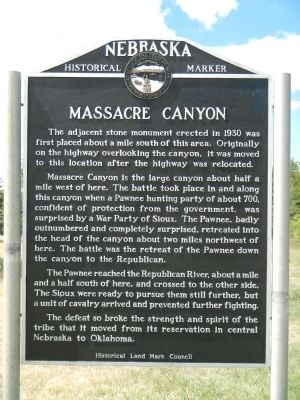
Massacre Canyon is the large canyon about half a mile west of here. The battle took place in and along this canyon when a Pawnee hunting party of about 700, confident of protection from the government, was surprised by a War Party of Sioux. The Pawnee, badly outnumbered and completely surprised, retreated into the head of the canyon about two miles northwest of here. The battle was the retreat of the Pawnee down the canyon to the Republican.
The Pawnee reached the Republican River, about a mile and a half south of here, and crossed to the other side. The Sioux were ready to pursue them still further, but a unit of cavalry arrived and prevented further fighting.
The defeat so broke the strength and the spirit of the tribe that it moved from its reservation in central Nebraska to Oklahoma.
Erected by Historical Land Mark Council. (Marker Number 8.)
Topics and series. This historical marker is listed
this page online
Location. 40° 12.434′ N, 100° 57.804′ W. Marker is near Trenton, Nebraska, in Hitchcock County. It is on U.S. 34 near Old Highway 34, on the right when traveling east. Touch for map. Marker is in this post office area: Trenton NE 69044, United States of America. Touch for directions.

Regionally, this marker is in Eastern Nebraska and in the Republican River Valley. It is also in the American Midwest, in the Corn Belt, and on the prairies. Globally, it is in North America, the Western Hemisphere, the Western World, and the Anglosphere. Historically, it finds itself in what was once the Louisiana Purchase.
Other nearby markers. At least 3 other markers are within 13 miles of this marker, measured as the crow flies: Old Texas Ogallala Trail (approx. 4.3 miles away); Culbertson (approx. 6.8 miles away); Prisoners of War in Hitchcock County (approx. 12½ miles away).
More about this marker. This marker is located
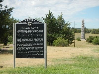
Also see . . . Massacre Canyon - Wikipedia. The battle occurred when a combined Oglala/Brulé Sioux war party of over 1000 warriors attacked a party of Pawnee on their summer buffalo hunt. According to Indian agent John W. Williamson, who accompanied the hunting party, "On the 2d day of July, 1873, the Indians, to the number of 700, left Genoa for the hunting grounds. Of this number 350 were men, the balance women and children." (Submitted on December 4, 2014, by Barry Swackhamer of Brentwood, California.)
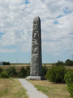
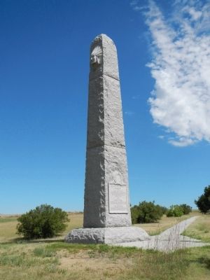
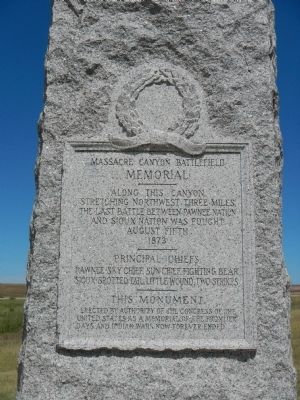
Memorial
Along this canyon stretching northwest three miles the last battle between Pawnee Nation and Sioux Nation was fought
August fifth
1873
Principal Chiefs
Pawnee - Sky Chief, Sun Chief, Fighting Bear
Sioux - Spotted Tail, Little Wound, Two Strikes
This Monument
Erected by authority of the Congress of the United States as a memorial to the frontier days and Indian wars now forever ended.
Credits. This page was last revised on June 16, 2016. It was originally submitted on December 4, 2014, by Barry Swackhamer of Brentwood, California. This page has been viewed 1,533 times since then and 63 times this year. Photos: 1, 2, 3, 4, 5. submitted on December 4, 2014, by Barry Swackhamer of Brentwood, California. • Bill Pfingsten was the editor who published this page.
