
Rogersville in Lauderdale County, Alabama — The American South (East South Central)
Covington/Second Creek
⎯⎯⎯
Wheeler Dam/Lake
Photographed by Sandra Hughes, December 25, 2014
1. Covington/Second Creek marker
(side 1)
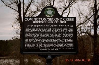
Covington/Second Creek
Goodsprings Church
This site, one mile east of Elgin, has been referred to as “The Indian Mound.” There were white landowners here as early as 1833. Prior to 1936, there was a thriving community, Covington, located between here and the northern bank. At its eastern boundary was a creek, referred to as Second Creek as early as 1817. It entered Lauderdale Co., AL, from Lawrence Co., TN, north of here, flowed through a creek bottom in this area which was used for farming and converged with the Tennessee River. An early road ran through Covington from the eastern bank, approximately .5 miles north of the current bridge, diagonally southwest to within 50 feet of the modern-day Highway 72. A one-lane metal bridge, with a plank floor, was installed over the creek. By February 1875, Covington had a post office. It moved to Rogersville in February 1897. The community also had a school. In 1839, the Goodsprings Cumberland Presbyterian Church was organized by Felix Johnson at the Goodsprings Campground. In April 1861, the congregation divided and a church was organized at Center Star.
this page online
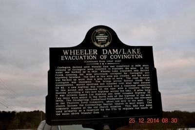
Wheeler Dam/Lake
Evacuation of Covington
Photographed by Sandra Hughes, December 25, 2014
2. Wheeler Dam/Lake marker
Erected 2014 by Eastern Lauderdale Historic Society.
Topics. This historical marker is listed in these topic lists: Religion & Religious Structures • Roads & Vehicles • Settlements & Settlers • Waterways & Vessels. A significant historical month for this entry is February 1875.
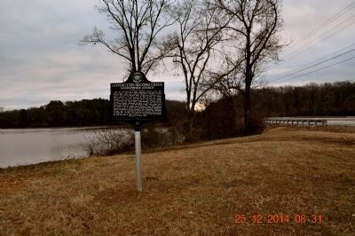
Location. 34° 50.622′ N, 87° 22.352′ W. Marker is in Rogersville, Alabama, in Lauderdale County. It is on Lee Highway (U.S. 72) 0.4 miles east of County Route 113, on the right when traveling east. Touch for map. Marker is in this post office area: Rogersville AL 35652, United States of America. Touch for directions.

Regionally, this marker is in North Alabama and in the Shoals. It is also in the American South, specifically in the Deep South, in Appalachia, and specifically in Southern Appalachia. Globally,
Photographed by Sandra Hughes, December 25, 2014
3. Covington/Second Creek / Wheeler Dam/Lake marker
Other nearby markers. At least 8 other markers are within 4 miles of this marker, measured as the crow flies: Elgin/Elgin Crossroads (approx. 1.2 miles away); Bettie Anne Highway (approx. 2 miles away); Wheeler Dam / Wheeler Reservoir/Locks (approx. 2.1 miles away); Daniel White (approx. 2.3 miles away); Cherokee Chief Doublehead's Village Around 1800 (approx. 2.4 miles away); Samuel Burney: 1763-1849 Revolutionary War Veteran / Burneys Creek/First Creek Wheeler Lake (approx. 3.1 miles away); Gabriel “Old Gabe” Butler (approx. 3.1 miles away); Springfield Community / Springfield Church and School (approx. 3.2 miles away). Touch for a list and map of all markers in Rogersville.
Photographed by Sandra Hughes, August 26, 1996
4. Second Creek Bridge
Credits. This page was last revised on June 16, 2016. It was originally submitted on December 27, 2014, by Sandra Hughes Tidwell of Killen, Alabama, USA. This page has been viewed 2,012 times since then and 105 times this year. Photos: 1, 2, 3, 4. submitted on December 27, 2014, by Sandra Hughes Tidwell of Killen, Alabama, USA. • Bernard Fisher was the editor who published this page.
