Tracys Landing in Anne Arundel County, Maryland — The American Northeast (Mid-Atlantic)
Chesapeake Bay Wetlands
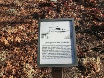
Photographed by Don Morfe, December 26, 2014
1. Chesapeake Bay Wetlands Marker
Topics. This historical marker is listed in these topic lists: Environment • Waterways & Vessels.
Location. 38° 46.332′ N, 76° 33.882′ W. Marker is in Tracys Landing, Maryland, in Anne Arundel County. It is on Old Deale Road. The marker is on the grounds of Herrington Harbour North. Touch for map. Marker is in this post office area: Tracys Landing MD 20779, United States of America. Touch for directions.

Regionally, this marker is in Central Maryland. It is also in the American Mid-Atlantic, in the Chesapeake Bay Region, and on the Eastern Seaboard. Globally, it is in the North Atlantic Region, North America, the Western Hemisphere, the Western World, and the Anglosphere.
this page online
Other nearby markers. At least 8 other markers are within 5 miles of this marker, measured as the crow flies: Wildlife You May See (within shouting distance of this marker); Outnumbered (approx. 0.3 miles away); Birds of Prey (approx. 0.3 miles away); The Town of Herrington: Unearthing the Origins of South County (approx. 0.3 miles away); Anne and Christopher Birckhead (approx. 2.2 miles away); Saint James’ Church (approx. 2.2 miles away); Holly Hill (approx. 3 miles away); Women of Hartge Yacht Yard (1934-2006) (approx. 4.7 miles away). Touch for a list and map of all markers in Tracys Landing.
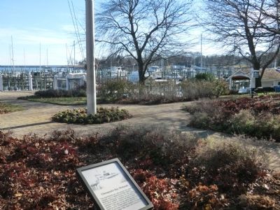
Photographed by Don Morfe, December 26, 2014
2. Chesapeake Bay Wetlands Marker
Credits. This page was last revised on June 16, 2016. It was originally submitted on December 30, 2014, by Don Morfe of Baltimore, Maryland. This page has been viewed 434 times since then and 8 times this year. Photos: 1, 2. submitted on December 30, 2014, by Don Morfe of Baltimore, Maryland. • Bill Pfingsten was the editor who published this page.
