Near Winchester in Frederick County, Virginia — The American South (Mid-Atlantic)
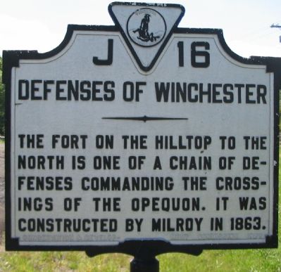
Defenses of Winchester
Erected 1929 by Conservation & Development Commission. (Marker Number J-16.)
Topics. This historical marker is listed in these topic lists: Forts and Castles • War, US Civil. A significant historical year for this entry is 1863.
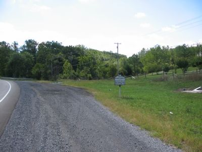
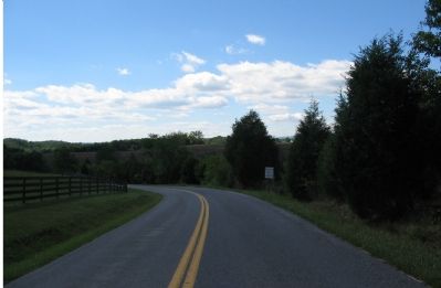
Location. This marker has been replaced by another marker nearby. It was located near 39° 6.321′ N, 78° 9.538′ W. Marker was near Winchester, Virginia, in Frederick County. Marker was on Front Royal Pike (U.S. 522), on the right when traveling south. Touch for map. Marker was in this post office area: Stephens City VA 22655, United States of America. Touch for directions.
Other nearby markers. At least 8 other markers are within 3 miles of this location, measured as the crow flies. Camp Russell (about 500 feet away, measured in a direct line); Second Battle of Winchester (approx. 2.3 miles away); First Battle of Winchester (approx. 2.3 miles away); House of First Settler (approx. 2.4 miles away); First Battle of Kernstown (approx. 2.8 miles away); The Battle Begins: "I had murder in my heart" (approx. 2.8 miles away); Second Winchester "Bringing fire and tempests on the world" (approx. 2.8 miles away); Clark County / Frederick County (approx. 2.8 miles away). Touch for a list and map of all markers in Winchester.
Related marker. Click here for another marker that is related to this marker. New Marker At This Location titled "Camp Russell".
Also see . . . Second Battle of Winchester. Detailed description of the defenses of Winchester, in addition to the description of the battle. (Submitted on October 21, 2007, by Craig Swain of Leesburg, Virginia.)
Additional commentary.
1. Site of Defenses
The location of the referenced fortifications is somewhat hazy. After comparing modern topographical maps to contemporary maps from the Official Records, it appears the southern tier of defenses of Winchester were in the vicinity of the present day intersection of the Front Royal Pike (US Highway 522) and Millwood Pike (US Highways 17/50), partly leveled by the I-81 interchange nearby. This places the fortifications some three miles to the north.
This marker references an extended fortification standing to the north of the crossing of Opequon Creek and the Front Royal Pike, protecting that important avenue of approach to Winchester. The fortification was noted as "Parkins Mill Battery."
In either case, a battery of artillery and a detached Federal force faced Confederate General Edward Johnson's Division on June 13, 1863 in the southern most defenses of Winchester.
— Submitted September 24, 2007, by Craig Swain of Leesburg, Virginia.
Credits. This page was last revised on April 24, 2023. It was originally submitted on September 23, 2007, by Craig Swain of Leesburg, Virginia. This page has been viewed 1,779 times since then and 40 times this year. Last updated on January 17, 2015, by J. Makali Bruton of Accra, Ghana. Photos: 1, 2. submitted on September 23, 2007, by Craig Swain of Leesburg, Virginia. 3. submitted on October 21, 2007, by Craig Swain of Leesburg, Virginia. • Bill Pfingsten was the editor who published this page.


