Monteith in Chatham County, Georgia — The American South (South Atlantic)
Mulberry Grove Plantation
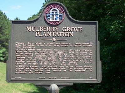
Mulberry Grove which is located approximately 2 miles northeast from this marker is one of the most historic of the old Savannah River plantations.
In early Colonial days mulberry trees were cultivated at Mulberry Grove for use in Georgia's silk industry. Later it became one of the leading rice plantations of Georgia. At the end of the Revolution the plantation, which had belonged to Lieutenant Governor John Graham, a Royalist, was granted by the State of Georgia to major General Nathanael Greene as a reward for his military services. General Greene was residing at Mulberry Grove at the time of his death on June 12, 1786.
In 1793 Eli Whitney, who was the tutor of the Greene children, invented the cotton gin at Mulberry Grove. The following year a large ginning machine was erected at the plantation. Its foundation still stands there.
Erected 1956 by Georgia Historical Commission. (Marker Number 25-39.)
Topics and series. This historical marker is listed in these topic lists: Colonial Era • Notable Places • Settlements & Settlers. In addition, it is included in the Georgia Historical Society series list. A significant historical date for this entry is June 12, 1786.
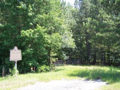
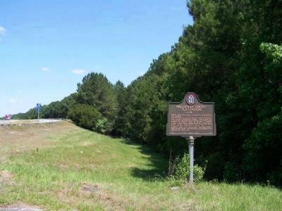
Location. 32° 10.846′ N, 81° 11.271′ W. Marker is in Monteith, Georgia, in Chatham County. Marker is on Augusta Road (State Highway 21/30) north of Drakie Road, on the right when traveling north. Touch for map. Marker is in this post office area: Port Wentworth GA 31407, United States of America. Touch for directions.
Other nearby markers. At least 8 other markers are within 4 miles of this marker, measured as the crow flies. Washington's Southern Tour (here, next to this marker); Richmond Baptist Church (approx. 1.6 miles away); Atlantic Coastal Highway Through Georgia (approx. 2 miles away); Savannah River Plantations (approx. 2.1 miles away); Historic Ship Anchor (approx. 2.6 miles away); Gulfstream Aerospace Corp. (approx. 2.8 miles away); Indian Trading Post: Home of Mary Musgrove (approx. 3.2 miles away); Battle Between Confederate Gunboats and Union Field Artillery (approx. 3.2 miles away).
More about this marker. This marker was previously located at US 17 near the City Hall in Port Wentworth (Coordinates: N32.146846929, W81.161335817).
Regarding Mulberry Grove Plantation. Mulberry Grove plantation, including the surrounding 2,141 acres, was presented to Nathanael Greene by the State of Georgia. In late October of 1785, Greene moved his family to the rice plantation on the Savannah River. The estate had fallen into disrepair since its previous owner, John Graham, Loyalist lieutenant governor of the state, had fled the country ten years earlier.
The state awarded the neighboring Richmond and Kew plantation to Greene's comrade, Major General Anthony Wayne, who played a vital role in defeating the British forces in Georgia. A couple of years earlier, Greene had purchased a half-interest in Cumberland and Little Cumberland Islands off of the southern coast of Georgia. He hoped to cultivate the oak trees on the property for ship-builders.
After Greene's death, George Washington visited Mulberry Grove in 1791. A couple of years later, Eli Whitney of Connecticut, a guest of Catharine Greene's, invented his cotton gin at the estate. In 1796, Catharine Greene married Phineas Miller, who had originally come to Georgia as Greene's secretary. Two years later, they were forced to sell the plantation because of mounting debt and they moved to Cumberland Island where they built the estate of Dungeness in 1802.
During Sherman's March to the Sea, Union soldiers burned Mulberry Grove to the ground. A series of coastal storms in the early twentieth century ensured the detioration of the property. In the 1970s, the Georgia Port Authority finished the job that the federal government had begun and destroyed what was left of the estate. Unfortunately, Dungeness also burned to the ground in 1866. It was rebuilt by Thomas M. Carnegie in 1884, but this house was
also destroyed by fire in 1959.
Credits. This page was last revised on November 24, 2019. It was originally submitted on June 1, 2008, by Mike Stroud of Bluffton, South Carolina. This page has been viewed 10,046 times since then and 143 times this year. Photos: 1, 2, 3. submitted on June 1, 2008, by Mike Stroud of Bluffton, South Carolina. • Kevin W. was the editor who published this page.


