
Java Plantation Life
Hoe to Plow
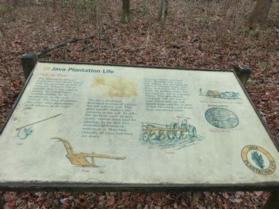
The Java plantation flourished because of tobacco, but not without cost. This plant quickly depletes the nutrients in the soil. To solve this problem, early settlers simply cleared more land for planting. In the first two centuries of European settlement in Maryland, virtually all trees had been cut down.
Growing tobacco was hard work. Working with a hoe was tedious, but disturbed the soil to a minimal depth. The plow, invented in the 1790s made the process easier, but disturbed the soil to a greater degree. This disturbance, combined with the loss of trees which hold the soil, greatly increased the erosion of soil into creeks and rivers from precolonial times.
(Inscriptions under the images from left to right)
Hoe, Plow, Tractor, Rolling a hogshead filed with tobacco, Tobacco Stamp.
Topics. This historical marker is listed
this page online
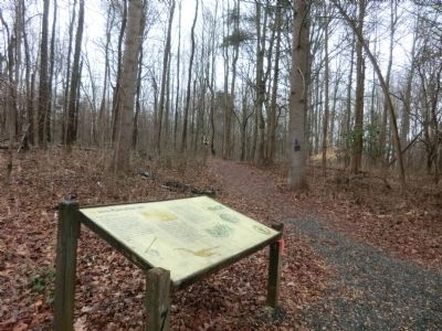
Location. 38° 53.349′ N, 76° 32.929′ W. Marker is in Edgewater, Maryland, in Anne Arundel County. It is on Dock Road. The marker is near the Java Farm Tobacco Barn. It is on the grounds of the Smithsonian Environmental Research Center. Touch for map. Marker is in this post office area: Edgewater MD 21037, United States of America. Touch for directions.

Regionally, this marker is in Central Maryland. It is also in the American Mid-Atlantic, in the Chesapeake Bay Region, and on the Eastern Seaboard. Globally, it is in the North Atlantic Region, North America, the Western Hemisphere, the Western World, and the Anglosphere. Historically, it finds itself in what was once one of the original Thirteen Colonies and also the Antebellum South.
Other nearby markers. At least 8 other markers are within 2 miles of this marker, measured as the crow flies: A different marker also named Java Plantation Life (a few steps from this marker); a different marker also named Java Plantation Life (a few steps from this marker); a different marker
Credits. This page was last revised on June 16, 2016. It was originally submitted on February 15, 2015, by Don Morfe of Baltimore, Maryland. This page has been viewed 538 times since then and 12 times this year. Photos: 1, 2, 3. submitted on February 15, 2015, by Don Morfe of Baltimore, Maryland. • Bill Pfingsten was the editor who published this page.
