The California - Oregon Trail
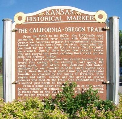
From the 1830's to the 1870's, the 2,000-mile road connecting Missouri river towns with California and Oregon was America's greatest transcontinental highway. Several routes led west from the river, converging into one trail by the time the Fort Kearny (Neb.) vicinity was reached. One of them began near present Kansas City and passed this point, crossing Rock creek not far from the highway bridge.
Here a great campground was located because of the several fine springs in the vicinity. Scott spring, 180 yards north, still offers the "delicious cold water" mentioned by one traveler in 1846. Local legend says that at times the whole of what is now the Westmoreland townsite was covered by the camps of travelers, their wagons and cattle. Nearby are the graves of several pioneers who died on the trail. One unidentified grave is located just north of the spring.
From a point about two miles south of this marker Kansas highway 99 follows the trail to Westmoreland. In places ruts of the old trail may still be seen from the modern traveler's car window.
Erected by Kansas Historical Society and State Highway Commission.
this page online
Topics and series. This historical marker is listed in these topic lists: Environment • Roads & Vehicles • Settlements & Settlers. In addition, it is included in the California Trail, the Kansas Historical Society, and the Oregon Trail series lists. A significant historical year for this entry is 1846.
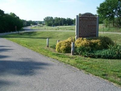
Location. 39° 22.875′ N, 96° 24.311′ W. Marker is near Westmoreland, Kansas, in Pottawatomie County. It is on The Road to Oz Highway (State Highway 99), on the right when traveling south. Marker is at a roadside pullout, about 500 feet south of the entrance to Oregon Trail Park. Touch for map. Marker is in this post office area: Westmoreland KS 66549, United States of America. Touch for directions.

Regionally, this marker is in Eastern Kansas and specifically in Bleeding Kansas Border War Country. It is also in the American Midwest, in the Corn Belt, on the prairies, and on the Southern Plains. Globally, it is in North America, the Western Hemisphere, the Western World, and the Anglosphere. Historically, it finds itself in what was once the Louisiana Purchase.
Other nearby markers. At least 8
Also see . . .
1. Oregon National Historic Trail. National Park Service website entry (Submitted on February 19, 2015, by William Fischer, Jr. of Reynoldsburg, Ohio.)
2. California National Historic Trail. National Park Service website entry (Submitted on February 19, 2015, by William Fischer, Jr. of Reynoldsburg, Ohio.)
3. Oregon-California Trails Association. Association website entry (Submitted on February 19, 2015, by William Fischer, Jr. of Reynoldsburg, Ohio.)
4. Westmoreland, Kansas. City Chamber of Commerce website homepage (Submitted on February 19, 2015, by William Fischer, Jr. of Reynoldsburg, Ohio.)
5. Pottawatomie County in Cutler's History of Kansas (1883). Kansas Collection Books website entry (Submitted on February 19, 2015, by William Fischer, Jr. of Reynoldsburg, Ohio.)
Credits. This page was last revised on January 28, 2022. It was originally submitted on February 19, 2015, by William Fischer, Jr. of Reynoldsburg, Ohio. This page has been viewed 1,157 times since then and 56 times this year. Photos: 1, 2. submitted on February 19, 2015, by William Fischer, Jr. of Reynoldsburg, Ohio.
