One Step at a Time
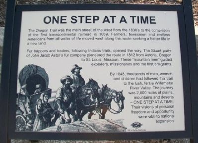
The Oregon Trail was the main street of the west from the 1830's to the completion of the first transcontinental railroad in 1869. Farmers, townsmen and restless Americans from all walks of life moved along this route seeking a better life in a new land.
Fur trappers and traders, following Indian trails, opened the way. The Stuart party of John Jacob Astor's fur company pioneered the route in 1812 from Astoria, Oregon to St. Louis, Missouri. These "mountain men" guided explorers, missionaries and the first emigrants.
By 1848, thousands of men, women and children had followed this trail to the lush, fertile Willamette River Valley. The journey was 2,000 miles of plains, mountains and deserts - ONE STEP AT A TIME. Their visions of personal freedom and opportunity were vital to national expansion.
Erected by Sylvia Galloway.
Topics and series. This historical marker is listed in these topic lists: Environment • Exploration • Roads & Vehicles • Settlements & Settlers. In addition, it is included in the Oregon Trail series list. A significant historical year for this entry is 1869.
Location. 39° 22.993′ N, 96° 24.351′ W. Marker is near Westmoreland, Kansas, in Pottawatomie County. Marker is on The Road to Oz Highway
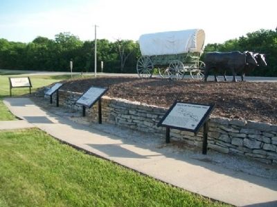
Other nearby markers. At least 8 other markers are within walking distance of this marker. The Long Journey (here, next to this marker); The Wagon & Team • Supplies Needed (here, next to this marker); Route of the Oregon Trail (here, next to this marker); Archeological Site 14-PO1311 (within shouting distance of this marker); Tallgrass Prairie (within shouting distance of this marker); Scott Spring (about 300 feet away, measured in a direct line); Wagons Fording Rock Creek (about 300 feet away); Burial Site of Oregon Trail Traveler (about 300 feet away). Touch for a list and map of all markers in Westmoreland.
Also see . . .
1. Oregon National Historic Trail. National Park Service website entry (Submitted on February 20, 2015, by William Fischer, Jr. of Scranton, Pennsylvania.)
2. People & Stories of the Oregon Trail. Oregon-California Trails Association website entry (Submitted on February 20, 2015, by William Fischer, Jr. of Scranton, Pennsylvania.)
3. Oregon-California Trail. Kansapedia website entry (Submitted on February 20, 2015, by William Fischer, Jr. of Scranton, Pennsylvania.)
4. The Fur Trade: "Beaver Powered Mountaineering". The Mountain Men website entry (Submitted on February 20, 2015, by William Fischer, Jr. of Scranton, Pennsylvania.)
Credits. This page was last revised on October 11, 2023. It was originally submitted on February 20, 2015, by William Fischer, Jr. of Scranton, Pennsylvania. This page has been viewed 348 times since then and 12 times this year. Photos: 1, 2. submitted on February 20, 2015, by William Fischer, Jr. of Scranton, Pennsylvania. 3. submitted on February 19, 2015, by William Fischer, Jr. of Scranton, Pennsylvania. 4. submitted on February 20, 2015, by William Fischer, Jr. of Scranton, Pennsylvania.


