Panama City in Bay County, Florida — The American South (South Atlantic)
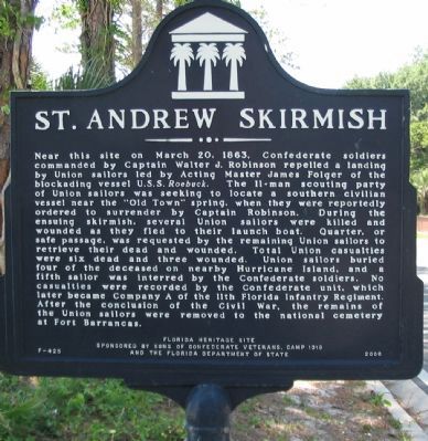
St. Andrew Skirmish
Erected 2000 by Sons of Confederate Veterans, Camp 1319 and the Florida Department of State. (Marker Number F-425.)
Topics and series. This historical marker is listed in this topic list: War, US Civil . In addition, it is included in the Sons of Confederate Veterans/United Confederate Veterans series list. A significant historical month for this entry is March 1861.
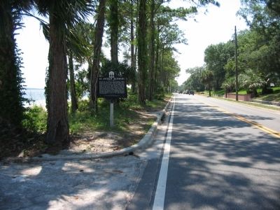
Location. Marker is missing. It was located near 30° 9.862′ N, 85° 41.252′ W. Marker was in Panama City, Florida, in Bay County. Marker was at the intersection of West Beach Drive (Business U.S. 98) and Friendship Avenue, on the right when traveling east on West Beach Drive. Located at a pull off along Beach Drive. Touch for map. Marker was in this post office area: Panama City FL 32401, United States of America. Touch for directions.
Other nearby markers. At least 8 other markers are within walking distance of this location. The St. Andrew Bay Saltworks (approx. 0.3 miles away); Oakland Cemetery (approx. ¾ mile away); John Christo, Senior (approx. 0.8 miles away); Buena Vista Point Archaeological Site (approx. 0.8 miles away); Lion Fountain (approx. 0.8 miles away); Historic St. Andrew Church (approx. 0.8 miles away); The Old Sentry (approx. 0.8 miles away); Salt Kettle (approx. 0.8 miles away). Touch for a list and map of all markers in Panama City.
Also see . . . Missing Civil War historical marker (Nexstar Media Inc.). The marker disappeared around the time Hurricane Michael hit (Oct 7, 2018 – Oct 11, 2018). It is not believed to have gone missing due to the hurricane as their is no damage to the bolt holes and the bolts were not found near the pole still standing. (Submitted on June 28, 2023, by Mark Hilton of Montgomery, Alabama.)

Photographed By Craig Swain, May 29, 2008
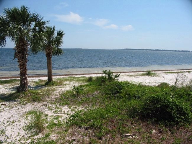
3. St. Andrew Bay
Hurricane Island was one of four Islands at the mouth of St Andrew Bay at the time of the Civil War. The others were Sand, Hammock, and Crooked Islands. A hurricane in 1868 shifted the barrier islands around considerably, and the resultant land was renamed Shell Island. Shell Island sits in the far distance, just right of the palm trees.
Credits. This page was last revised on June 28, 2023. It was originally submitted on June 5, 2008, by Craig Swain of Leesburg, Virginia. This page has been viewed 5,861 times since then and 89 times this year. Photos: 1, 2, 3. submitted on June 5, 2008, by Craig Swain of Leesburg, Virginia.

