Capitol District in Richmond, Virginia — The American South (Mid-Atlantic)
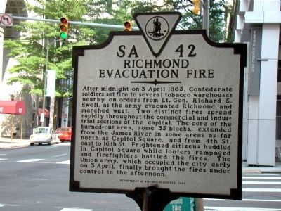
Richmond Evacuation Fire
Erected 1995 by Department of Historic Resources. (Marker Number SA–42.)
Topics and series. This historical marker is listed in this topic list: War, US Civil. In addition, it is included in the Virginia Department of Historic Resources (DHR) series list. A significant historical date for this entry is April 3, 1865.
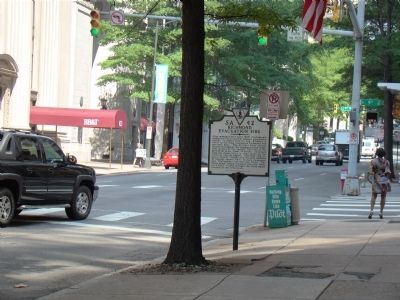
Location. 37° 32.289′ N, 77° 26.17′ W. Marker is in Richmond, Virginia. It is in the Capitol District. Marker is at the intersection of East Main Street (U.S. 60) and 9th Street, on the left when traveling east on East Main Street. Touch for map. Marker is in this post office area: Richmond VA 23219, United States of America. Touch for directions.
Other nearby markers. At least 8 other markers are within walking distance of this marker. The First National Bank Building (within shouting distance of this marker); Richmond Bread Riot (about 300 feet away, measured in a direct line); Oliver White Hill Sr. (about 300 feet away); Anna Maria Lane (about 300 feet away); The Bell Tower (about 400 feet away); Mantle (about 400 feet away); Great Turning Basin (about 600 feet away); Edgar Allen Poe (about 600 feet away). Touch for a list and map of all markers in Richmond.
More about this marker. Marker is one block south of Capitol Square.
Also see . . .
1. About the Burning of Richmond. First-hand account by H.H. Sturgis, the person who started the fire, published in the Confederate Veteran in 1909. (Submitted on June 5, 2008.)
2. Burning of Richmond / Last to Cross Mayo’s Bridge. 1897 letter by Lieutenant-Colonel R.T.W. Duke to the Richmond Dispatch. “...I turned and looked back; the city of Richmond was in flames. From all the windows of the Gallego Mills tongues of flame were bursting out; dense clouds of smoke, sparks and flames were reaching skyward. Were I a painter, even now, after thirty-two years, I could paint the scene. The sight was awfully grand. I felt the end was nigh. ...” (Submitted on June 5, 2008.)
Credits. This page was last revised on February 1, 2023. It was originally submitted on June 5, 2008, by J. J. Prats of Powell, Ohio. This page has been viewed 1,858 times since then and 121 times this year. Photos: 1, 2. submitted on June 5, 2008, by J. J. Prats of Powell, Ohio. • Craig Swain was the editor who published this page.

