Jeremiah Warder and Ann Aston Warder
1780 - 1849 and 1781 - 1871
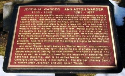
Jeremiah and his wife Ann, wealthy Quakers from Philadelphia, arrive in Springfield in 1830 to claim extensive acreage inherited from his late father’s estate. That same year, he purchases from the estate the village of Lagonda consisting of several dwellings, saw mills, a woolen mill, and a gristmill with additional plans to build a large mill with a dam over the stream in order to increase water power for more mills. He purchases the “Western Pioneer”, the local newspaper in 1831. Warder desires to improve the quality in Springfield with the founding of a literary club, the Springfield Lyceum, from which our first library grew. He is also instrumental in the incorporation of Springfield High School into the city of Springfield in 1833. Warder helps to stimulate the town’s economic and industrial prosperity. Also, he is involved with the politics of bringing the National Road through Springfield.
Ann Aston Warder, fondly known as “Mother Warder”, also contributes greatly to the community spirit improving social affairs and providing proper educational training for local children. She opens a
this page online
Topics. This historical marker is listed in these topic lists: Abolition & Underground RR • Cemeteries & Burial Sites • Education • Settlements & Settlers. A significant historical year for this entry is 1830.
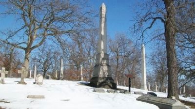
Location. 39° 56.137′ N, 83° 49.214′ W. Marker is in Springfield, Ohio, in Clark County. It can be reached from West McCreight Avenue. Marker is in Section C of Ferncliff Cemetery. Touch for map. Marker is at or near this postal address: 501 West McCreight Avenue, Springfield OH 45504, United States of America. Touch for directions.

Regionally, this marker is in the Dayton Metro and in the Miami Valley. It is also in the American Midwest and in the Corn Belt. Globally, it is in North America, the Western Hemisphere, the Western World, and the Anglosphere. Historically, it finds itself in what
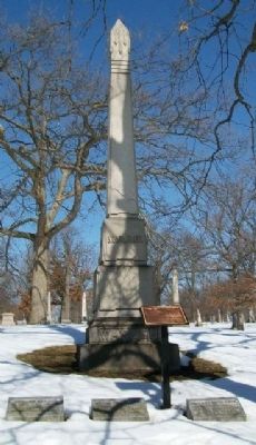
Other nearby markers. At least 8 other markers are within walking distance of this marker: Oliver Smith Kelly (within shouting distance of this marker); Clark County Revolutionary War Memorial (about 300 feet away, measured in a direct line); William Whiteley (about 300 feet away); John Ludlow (about 400 feet away); John Dick (about 400 feet away); James Leffel (about 500 feet away); Union Soldiers Monument (about 800 feet away); United States Colored Troops (approx. 0.2 miles away). Touch for a list and map of all markers in Springfield.
Credits. This page was last revised on November 30, 2024. It was originally submitted on March 24, 2015, by William Fischer, Jr. of Reynoldsburg, Ohio. This page has been viewed 1,322 times since then and 100 times this year. Photos: 1, 2, 3, 4, 5. submitted on March 24, 2015, by William Fischer, Jr. of Reynoldsburg, Ohio.
