St. Simons Island in Glynn County, Georgia — The American South (South Atlantic)
Fort St. Simons
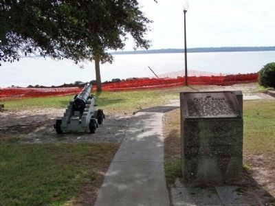
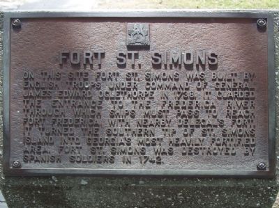
On this site Fort St. Simons was built by English troops under command of General James Edward Oglethorpe in 1738. It guarded the entrance to the Frederica River through which ships must pass to reach Fort Frederica. With nearby Delegal's Fort, it turned the southern tip of St. Simons Island into Georgia's most heavily fortified area. Fort St. Simons was destroyed by Spanish soldiers in 1742.
Topics. This historical marker is listed in these topic lists: Colonial Era • Forts and Castles • Notable Places. A significant historical year for this entry is 1738.
Location. 31° 8.045′ N, 81° 23.61′ W. Marker is on St. Simons Island, Georgia, in Glynn County. Marker is on 12th Street, on the right when traveling south. At St. Simons Lighthouse site. Touch for map. Marker is at or near this postal address: 101 12th Street, Saint Simons Island GA 31522, United States of America. Touch for directions.
Other nearby markers. At least 8 other markers are within walking distance of this marker. Historic St. Simons Lighthouse (a few steps from this marker); Couper's Point (a few steps from this marker); Early History of St. Simons Island (a few steps from this marker); The First Lighthouse ~ 1810 (a few steps from this marker); The Historic St. Simons Light Station (a few steps from this marker); Keepers of the Light (within shouting distance of this marker); a different marker also named Fort St. Simons (within shouting distance of this marker); Welcome to St. Simons Light! (within shouting distance of this marker). Touch for a list and map of all markers in St. Simons Island.
Related marker. Click here for another marker that is related to this marker.
Also see . . . Forgotten Fort of St. Simons. (Submitted on March 23, 2015, by Mark Hilton of Montgomery, Alabama.)

Photographed By Mike Stroud, 2008
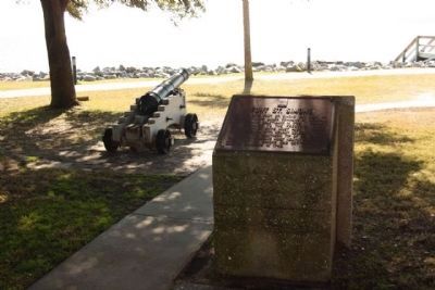
2. Fort St. Simons Marker, southern tip waterfront
Fort St. Simons was the first structure to occupy this land, ( St Simons Island), although an earlier fort (Delegal's) existed in the area. Fort St. Simons was built to watch for Spanish invaders, and was captured by the Spanish in 1742. It was from this site that the Spanish began to probe St. Simons Island looking for a rumored second fort built by Oglethorpe (Ft. Frederica). Troops searching for Frederica initiated the Battle of Bloody Marsh, fought on the island during the War of Jenkins Ear.
Credits. This page was last revised on November 23, 2020. It was originally submitted on November 13, 2008, by Mike Stroud of Bluffton, South Carolina. This page has been viewed 1,585 times since then and 15 times this year. Last updated on March 25, 2015, by J. Makali Bruton of Accra, Ghana. Photos: 1, 2. submitted on November 13, 2008, by Mike Stroud of Bluffton, South Carolina. 3. submitted on January 30, 2012, by Mike Stroud of Bluffton, South Carolina. • Bernard Fisher was the editor who published this page.

