Near Shawano in Shawano County, Wisconsin — The American Midwest (Great Lakes)
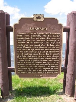
Shawano
State Trunk Highway 55 which passes along the main street of Shawano was part of the military road which was built from Green Bay to Ontonagon on Lake Superior. This road was authorized by an Act of Congress in 1863. After the Civil War it was used extensively by loggers and lumbermen as a supply road.
Erected 1956 by the Wisconsin Historical Society. (Marker Number 47.)
Topics and series. This historical marker is listed in these topic lists: Native Americans • Roads & Vehicles • Settlements & Settlers. In addition, it is included in the Wisconsin Historical Society series list. A significant historical year for this entry is 1863.
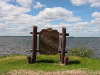
Location. 44° 47.215′ N, 88° 31.34′ W. Marker is near Shawano, Wisconsin, in Shawano County . Marker is on South Shore Drive (State Highway 22) 0.3 miles east of Cedar Avenue, on the left when traveling east. Parking is on the westbound shoulder. Touch for map. Marker is in this post office area: Shawano WI 54166, United States of America. Touch for directions.
Other nearby markers. At least 5 other markers are within 13 miles of this marker, measured as the crow flies. Menominee Reservation (approx. 7 miles away); Keshena Falls & The Menominee (approx. 9.6 miles away); Spirit Rock (approx. 11 miles away); Navarino Area Veterans Memorial (approx. 12.2 miles away); Sgt Avery Wilber Memorial Bridge (approx. 12.2 miles away).
Credits. This page was last revised on June 16, 2016. It was originally submitted on June 7, 2008, by Keith L of Wisconsin Rapids, Wisconsin. This page has been viewed 3,734 times since then and 55 times this year. Photos: 1, 2. submitted on June 7, 2008, by Keith L of Wisconsin Rapids, Wisconsin. • J. J. Prats was the editor who published this page.

