Carlton in Orleans County, New York — The American Northeast (Mid-Atlantic)
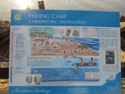
Fishing Camp
A Prehistoric Destination
— Maritime Heritage —
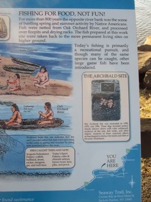
Fishing For Food, Not Fun!
For more than 800 years the opposite bank was the scene of bustling spring and summer activity by Native Americans. Fish were netted from Oak Orchard River, and processed over firepits and drying racks. The fish prepared at this work site were taken back to the more permanent living sites on higher ground.
Today's fishing is primarily a recreational pursuit, and though many of the same species can be caught, other large game fish have been introduced.
The Archibald Site was excavated in 1958, 1970, and 1986. These digs revealed pottery shards (shown above with color enhanced), evidence of fire pits, fish scales, and other objects. Analysis of these materials allows archaelologists to deduce the habits and diets of the early inhabitants.
Pottery Shards (fragments).
Lithics (decorative patterns) found on ceramic fragments allow archaeologists to determine the approximate age of the remains and to identify the peoples that produced the pots.
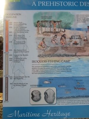
Iroquois Fishing Camp. Views are an artist's conception based on archaeological evidence.
The presence of netsinkers, fish scales, and firepits, and the absence of projectile points and hide processing tools, or other signs of permanent habitation, indicates that this was a specialized fishing encampment. Pottery patterns identify the most prominent inhabitants as Iroquois.
Thousands of netsinkers have been found at this site. The sinkers were rocks with notches chipped in the sides for the lines that were tied around them. They were used in combination with floats to hold the nets open.
Evidence from this site indicates that the early peoples netted fish that were spawning in the creek in spring and summer by using nets stretched across the river.
Fish Caught Then and Now.
Iroquois Subsistence Fishery: catfish, bullhead, drum, sucker, sturgeon, gar, and rock bass.
Today's Sport Fishery: coho & chinook salmon, brown trout, bass, pike, and perch.
Occupation Timeline.
2000 AD Modern Period.
1989 Marina Built
1986 Archeaological Dig Undertaken.
1958 Stanley Vanderlaan Finds Artifacts in Archeaologial Test Pits.
1803 First Europeans Settle Area.
1795 Maps Show Oak Orchard Harbor Labeled as 'Fishing Bay'.
1722 Six Nations of the Iroquois Formed.
1570 Five Nations Form Leaque[sic] of the Iroquois.
1550 AD Late Woodland Period.
1500 Iroquois Use Reaches a Peak.
1500-1400 A Pattern of Use by Iroquois People Develops.
1000 AD Middle Woodland Period.
1000-800 Owasco People Use the Site Regularly.
800 First evidence of Owasco People.
100 AD
Indigenous people found sustenance along the Seaway Trail long before explorers discovered its bounty.
Seaway Trail, Inc., Corner Ray & West Main St., Sackets Harbor, NY 13685. 1-800-SEAWAY-T. This exhibit made possible by a grant from FHWA to Seaway Trail, Inc.
Topics and series. This historical marker is listed in these topic lists: Anthropology & Archaeology • Environment • Native Americans. In addition, it is included in the Great Lakes Seaway Trail National Scenic Byway series list. A significant historical year for this entry is 1958.
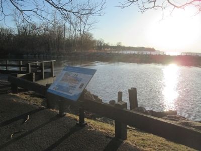
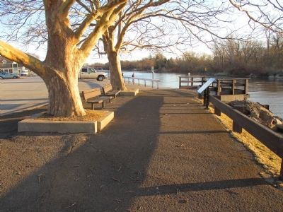
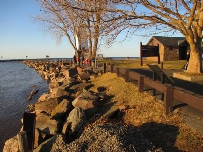
Location. 43° 22.312′ N, 78° 11.5′ W. Marker is in Carlton, New York, in Orleans County. Marker can be reached from Ontario Street, 0.1 miles north of Water Street. Marker is at the northwest end of the public parking area at the foot of Ontario Street. Touch for map. Marker is in this post office area: Kent NY 14477, United States of America. Touch for directions.
Other nearby markers. At least 8 other markers are within 6 miles of this marker, measured as the crow flies. Cobblestone Wall Section (approx. 0.7 miles away); July 1813 (approx. 1.3 miles away); Sir William Johnson (approx. 2.7 miles away); Fording Place (approx. 3.4 miles away); Johnson Creek (approx. 3.7 miles away); Kuckville Church erected in 1835 (approx. 3.8 miles away); Pioneer Settler (approx. 5.8 miles away); Home of Katherine Belle Rowley (approx. 5.8 miles away). Touch for a list and map of all markers in Carlton.
Credits. This page was last revised on May 2, 2021. It was originally submitted on April 27, 2015, by Anton Schwarzmueller of Wilson, New York. This page has been viewed 438 times since then and 18 times this year. Photos: 1, 2, 3, 4, 5, 6. submitted on April 27, 2015, by Anton Schwarzmueller of Wilson, New York.
