Ewell in Somerset County, Maryland — The American Northeast (Mid-Atlantic)
Smith Island
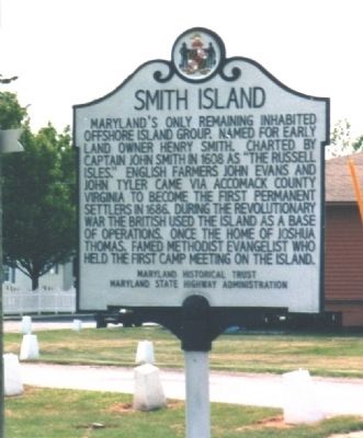
Maryland's only remaining inhabited offshore island group. Named for early land owner Henry Smith. Chartered by Captain John Smith in 1608 as "The Russell Isles." English farmers John Evans and John Tyler came via Accomack County Virginia to become the first permanent settlers in 1686. During the Revolutionary War the British used the island as a base of operations. Once the home of Joshua Thomas, famed Methodist evangelist who held the first camp meeting on the island.
Erected by Maryland Historical Trust, Maryland State Highway Administration.
Topics. This historical marker is listed in these topic lists: Churches & Religion • Colonial Era • Settlements & Settlers • War, US Revolutionary • Waterways & Vessels. A significant historical year for this entry is 1608.
Location. 37° 59.712′ N, 76° 1.956′ W. Marker is in Ewell, Maryland, in Somerset County. Marker is on Caleb Jones Road near Katies Alley, on the right when traveling east. Touch for map. Marker is in this post office area: Ewell MD 21824, United States of America. Touch for directions.
Other nearby markers. At least 8 other markers are within 11 miles of this marker, measured as the crow flies. Commerce on the Water (approx. 9.3 miles away); The Evolving Crisfield Harbor (approx. 9.3 miles away); Crisfield (approx. 9˝ miles away); J. Millard Tawes (approx. 9.7 miles away); 'Spirit Of The American Doughboy' (approx. 10.3 miles away); Searching for Water (approx. 10.3 miles away); The J. Millard Tawes Homeplace (approx. 10˝ miles away); Make Peace (approx. 11.1 miles away).
More about this marker. Smith Island is accessible only by boat. Vehicle travel on the island is limited.
Also see . . . Smith Island Cultural Center & Museum. Museum website homepage (Submitted on June 11, 2008, by Kevin W. of Stafford, Virginia.)

Photographed By Crisfield & Smith Island Cultural Alliance, Inc., March 21, 2003
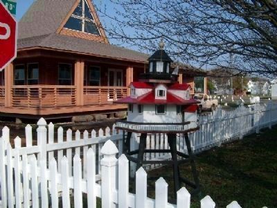
2. Smith Island Center, Birdhouse, and Marker
The Smith Island Center is the brown building on the left. Many yards in Ewell have birdhouses like this miniature lighthouse seen here. The historical marker can be seen in the distance, to the right of the birdhouse.
Credits. This page was last revised on August 22, 2022. It was originally submitted on June 11, 2008, by Kevin W. of Stafford, Virginia. This page has been viewed 1,839 times since then and 34 times this year. Photos: 1, 2. submitted on June 11, 2008, by Kevin W. of Stafford, Virginia.
