Bristol in Sullivan County, Tennessee — The American South (East South Central)
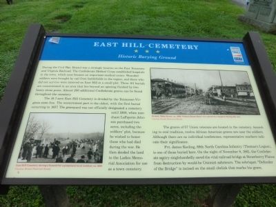
East Hill Cemetery
Historic Burying Ground
The 16.7-acre East Hill Cemetery is divided by the Tennessee-Virginia state line. The westernmost part is the oldest, with the first burial occurring in 1857. The graveyard was not officially designated a cemetery until 1868, when merchant LaFayette Johnson purchased two acres, including the soldiers’ plot, because he wished to honor those who had died during the war. He then deeded the land to the Ladies Memorial Association for use as a town cemetery.
The graves of 57 Union veterans are located in the cemetery. According to oral tradition, twelve African American graves are near the soldiers. Although there are no individual tombstones, representative markers indicated their significance.
Pvt. James Keeling, 69th North Carolina Infantry (Thomas’s Legion), is one of those buried here. On the night of November 8, 1861, the Confederate sentry singlehandedly saved the vital railroad bridge at Strawberry Plains from destruction by would-be Unionist saboteurs. The sobriquet “Defender of the Bridge” is incised on the small obelisk that marks his grave.
(captions)
East Hill Cemetery during a funeral for a prominent local resident, ca. 1900 Courtesy Bristol Historical Society
Bristol, Main Street, ca. 1900. Nichols House Hotel (left) served as a hospital during the war. Courtesy Bristol Historical Society
Erected by Tennessee Civil War Trails.
Topics and series. This historical marker is listed in these topic lists: Cemeteries & Burial Sites • War, US Civil. In addition, it is included in the Tennessee Civil War Trails series list. A significant historical date for this entry is November 8, 1927.
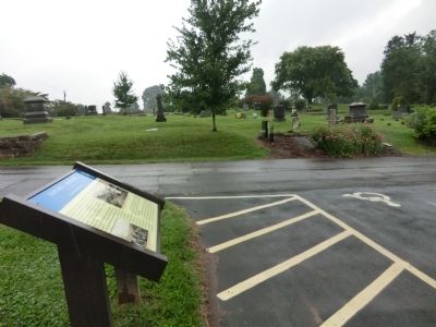
Location. 36° 35.625′ N, 82° 10.225′ W. Marker is in Bristol, Tennessee, in Sullivan County. Marker is on East Hill Cemetery Drive north of East State Street, on the right when traveling north. Marker is located in East Hill Cemetery. Touch for map. Marker is in this post office area: Bristol TN 37620, United States of America. Touch for directions.
Other nearby markers. At least 8 other markers are within walking distance of this marker. Founder of Bristol (about 600 feet away, measured in a direct line); City Historian (approx. 0.2 miles away in Virginia); Slave Section of East Hill Cemetery (approx. 0.2 miles away in Virginia); Parlett House (approx. 0.4 miles away); Evan Shelby (approx. 0.4 miles away); Confederate Hospital (approx. 0.6 miles away); Bristol Union Railway Station (approx. 0.6 miles away in Virginia); Historic Bristol (approx. 0.6 miles away in Virginia). Touch for a list and map of all markers in Bristol.
Credits. This page was last revised on June 16, 2016. It was originally submitted on August 3, 2013, by Don Morfe of Baltimore, Maryland. This page has been viewed 872 times since then and 45 times this year. Last updated on May 5, 2015, by J. Makali Bruton of Accra, Ghana. Photos: 1, 2. submitted on August 3, 2013, by Don Morfe of Baltimore, Maryland. • Andrew Ruppenstein was the editor who published this page.

