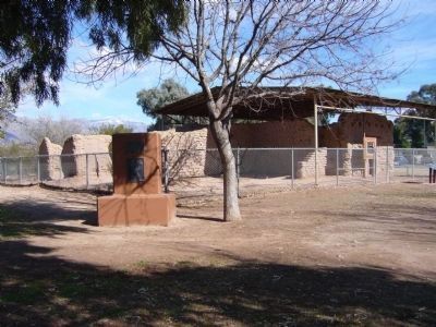
Old Fort Lowell in Tucson in Pima County, Arizona — The American Mountains (Southwest)
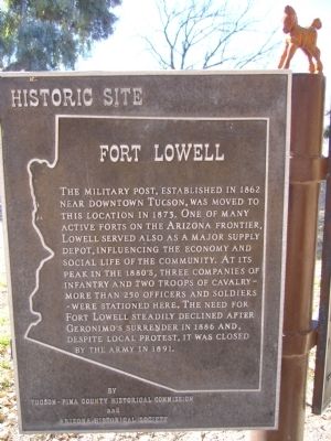
Fort Lowell
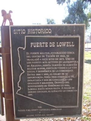
Spanish Translation Marker
Erected by Tucson - Pima County Historical Commission and Arizona Historical Society.
Topics. This historical marker is listed in these topic lists: Forts and Castles • War, US Civil • Wars, US Indian. A significant historical year for this entry is 1862.
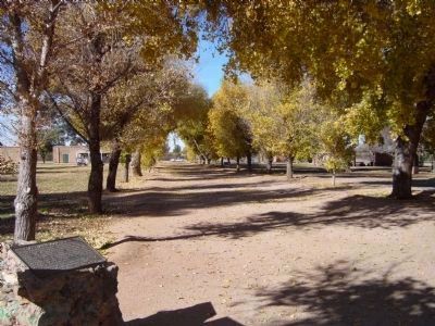
Location. 32° 15.594′ N, 110° 52.406′ W. Marker is in Tucson, Arizona, in Pima County. It is in Old Fort Lowell. Marker can be reached from North Craycroft Road near East Glenn Street. The Marker is inside Fort Lowell Park at the east end of the Cottonwood Lane. Fort Lowell is on North Craycroft Road just north of Glenn Street. Touch for map. Marker is at or near this postal address: 2900 North Craycroft Road, Tucson AZ 85712, United States of America. Touch for directions.
Other nearby markers. At least 8 other markers are within walking distance of this marker. Cottonwood Lane (here, next to this marker); a different marker also named Fort Lowell (within shouting distance of this marker); Fort Lowell 1873-1891 / Post Hospital (within shouting distance of this marker); Veterans Memorial (within shouting distance of this marker); Post Hospital (within shouting distance of this marker); Infantry Barracks / Laundresses' Quarters (about 300 feet away, measured in a direct line); The Fort Lowell Flagstaff (about 400 feet away); Officers' Quarters (about 500 feet away). Touch for a list and map of all markers in Tucson.
Additional commentary.
1. Fort Lowell (1860 - 1891)
The
Spanish established a Presidio (fortified camp} in Tucson about 1776 and remained until 1829. Mexican soldiers garrisoned the walled town until General Philip Cooke's Mormon Battalion arrived in 1846; after negotiations, the Mexicans departed. In 1860 the Camp Tucson was established on the present site of the Armory Park in Tucson. The fort was evacuated at the outbreak of the Civil War. The Confederate constitutional convention declared this section of Arizona no longer a part of the US in March 1861. Confederate forces made this Camp their headquarters once they occupied Tucson. Tucson returned to Union control when the California Volunteers pitched camp on the east side of town a year later.
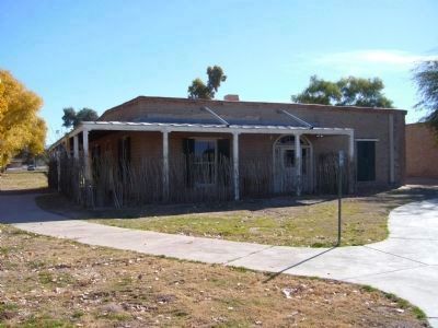
Post was too weak to be continued and was abandoned on September 15, 1864. The post was relocated at the Military Plaza and as renamed Camp Lowell in honor of Brig. Gen. Charls R. Lowell of the 6th Calvary, who was killed at Cedar Creek, Virginia during the Civil War. Renamed Fort Lowell, April 5, 1879. The camp was repositioned and improved. It became a major supply depot for troops in southern Arizona during many Indian actions, including the Geronimo Campaign. On April 5, 1891 the Fort was abandoned despite outcries by local Tucsonians who desired to maintain the post for its economic status. The rebuilt officers' quarters now contain a museum.
Source: http://jeff.scott.tripod.com/ftlowell.html
— Submitted January 4, 2010.
Historic American Buildings Survey (LOC)
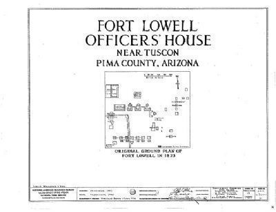
5. Original Ground Plan of Fort Lowell in 1873
Library of Congress, Prints and Photograph Division
HABS ARIZ,10-TUCSO.V,2-
Building/structure dates: 1874 initial construction
Building/structure dates: 1882 subsequent work
Building/structure dates: 1885 subsequent work
Click on photo for better viewing.
HABS ARIZ,10-TUCSO.V,2-
Building/structure dates: 1874 initial construction
Building/structure dates: 1882 subsequent work
Building/structure dates: 1885 subsequent work
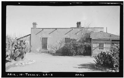
Photographed By Frederick D. Nichols, Photographer, circa 1938
6. Fort Lowell Officers Quarters
Historic American Buildings Survey (Library of Congress)
HABS ARIZ,10-TUCSO.V,2-A-
Click for more information.
HABS ARIZ,10-TUCSO.V,2-A-
Click for more information.
Credits. This page was last revised on August 30, 2020. It was originally submitted on January 4, 2010, by Bill Kirchner of Tucson, Arizona. This page has been viewed 2,196 times since then and 43 times this year. Last updated on May 6, 2015, by J. Makali Bruton of Accra, Ghana. Photos: 1, 2, 3, 4. submitted on January 4, 2010, by Bill Kirchner of Tucson, Arizona. 5, 6. submitted on January 4, 2010. 7. submitted on March 21, 2010, by Bill Kirchner of Tucson, Arizona. • Bill Pfingsten was the editor who published this page.
