
Arcadia in Oklahoma County, Oklahoma — The American South (West South Central)
Luke and Anna Robison
Photographed by William Fischer, Jr., May 6, 2015
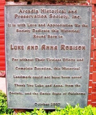
1. Luke and Anna Robison Marker
we the Society Dedicate this
Historical Round Barn to
Luke and Anna Robison
For without Their Tireless Efforts
and Complete Devotion, this
Historical Landmark could not
have been saved
Thank You Luke and Anna,
from the Society, and the
Entire State of Oklahoma
October 1997
Erected 1997 by Arcadia Historical and Preservation Society, Inc.
Topics. This historical marker is listed in these topic lists: Agriculture • Charity & Public Work • Man-Made Features. A significant historical month for this entry is October 1997.
Location. 35° 39.74′ N, 97° 19.568′ W. Marker is in Arcadia, Oklahoma, in Oklahoma County. It is on State Highway 66 east of Division Street, on the left when traveling east. Marker is at the Arcadia Round Barn. Touch for map. Marker is at or near this postal address: 107 East Highway 66, Arcadia OK 73007, United States of America. Touch for directions.

Regionally, this marker is in Central Oklahoma — Frontier Country and in Greater Oklahoma City. It is also in the American South, specifically on the prairies, and on the Southern Plains. Globally, it
this page online
Other nearby markers. At least 8 other markers are within walking distance of this marker: Frank and Katie Vrana (here, next to this marker); Arcadia Round Barn, Arcadia, Oklahoma (a few steps from this marker); Beverly and Karl White (a few steps from this marker); Everybody Had One (a few steps from this marker); Route 66 (within shouting distance of this marker); Tuton's Drugstore (about 400 feet away, measured in a direct line); Washington Irving's Camp (approx. half a mile away); a different marker also named Washington Irving's Camp (approx. half a mile away). Touch for a list and map of all markers in Arcadia.
Also see . . .
1. Arcadia Round Barn. Website homepage (Submitted on June 25, 2023, by Larry Gertner of New York, New York.)
2. History of Arcadia, Oklahoma. Town website homepage (Submitted on May 6, 2015, by William Fischer, Jr. of Reynoldsburg, Ohio.)
Photographed by William Fischer, Jr., May 6, 2015
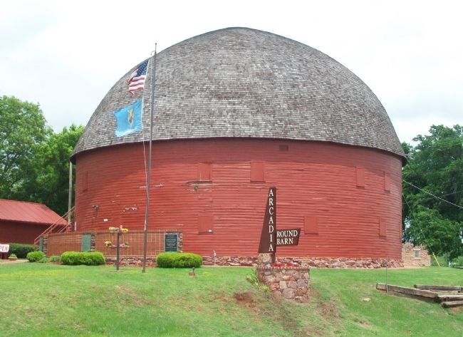
2. Luke and Anna Robison Marker
Credits. This page was last revised on June 25, 2023. It was originally submitted on May 6, 2015, by William Fischer, Jr. of Reynoldsburg, Ohio. This page has been viewed 554 times since then and 25 times this year. Photos: 1, 2. submitted on May 6, 2015, by William Fischer, Jr. of Reynoldsburg, Ohio.
