Tuscumbia in Colbert County, Alabama — The American South (East South Central)
History of Tuscumbia, Alabama
Photographed by Sandra Hughes, September 6, 2010
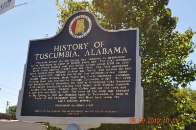
1. History of Tuscumbia Alabama Marker (side 1)
The area around the Big Spring was inhabited by prehistoric Native Americans as early as 10,000 years ago. The first settlement was a French trading post and Indian village about 1780 on Cold Water Creek (Spring Creek) near the river. The first permanent white settlers were Michael Dickson and family, who arrived by keel boat about 1817, followed shortly by four brothers-in-law, Isaiah McDill, James McMann, Hugh Finley and David Matthews. Jackson's Military Road was constructed through Tuscumbia in 1817. The town was incorporated on December 20, 1820 as Ococoposa (Oka Kapassa), a Chickasaw expression meaning Cold Water, with Thomas Limerick as the first mayor. General John Coffee laid out the town and a land sale was held in 1820. The name of the town was changed to Big Spring in 1821 and changed again to Tuscumbia in 1822 in honor of the Chickasaw chief who lived here when the early settlers arrived.
this page online
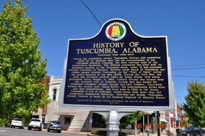
Tuscumbia is one of Alabama's oldest towns with more than 100 antebellum commercial buildings, churches and homes. Tuscumbia Historic District is listed on the National Register of Historic Places.
Erected 2010 by The Alabama Tourism Department And The City of Tuscumbia.
Topics and series. This historical marker is listed in these topic lists: Indigenous Peoples and Communities • Railroads & Streetcars
Photographed by Sandra Hughes, September 6, 2010
2. History of Tuscumbia Alabama Marker (side 2)
Location. 34° 43.878′ N, 87° 42.221′ W. Marker is in Tuscumbia, Alabama, in Colbert County. It is at the intersection of South Main Street and West 6th Street, on the right when traveling south on South Main Street. Touch for map. Marker is at or near this postal address: 111 W 6th St, Tuscumbia AL 35674, United States of America. Touch for directions.

Regionally, this marker is in North Alabama and in the Shoals. It is also in the American South, specifically in the Deep South, in Appalachia, and specifically in Southern Appalachia. Globally, it is in North America, a Gulf of Mexico state, the Western Hemisphere, the Western World, and the Anglosphere. Historically, it finds itself in what was once the territory of the Mississippian Culture, one of the Confederate States of America, and the Antebellum South.
Other nearby markers. At least 8 other markers are within walking distance of this marker: Petrified Conifer Tree / Petrified Lycopod Tree Stump
Photographed by Sandra Hughes, September 6, 2010
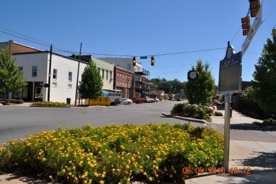
3. History of Tuscumbia Alabama Marker & Town
Also see . . . "Dedication Video" ::. (Submitted on June 10, 2011.)
Photographed by Sandra Hughes, December 20, 2009
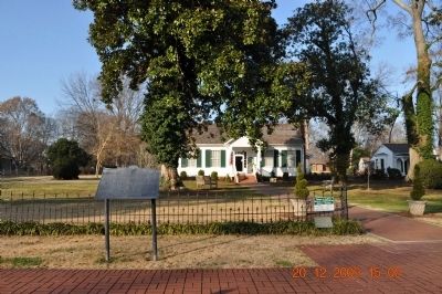
4. Helen Keller Birth Home
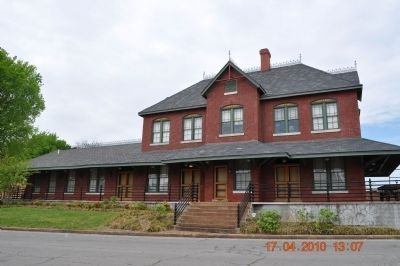
Photographed by Sandra Hughes, April 17, 2010
5. Train Depot In Tuscumbia
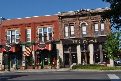
Photographed by Sandra Hughes, September 7, 2009
6. Tuscumbia Store Buildings
Credits. This page was last revised on September 29, 2020. It was originally submitted on September 7, 2010, by Sandra Hughes Tidwell of Killen, Alabama, USA. This page has been viewed 5,270 times since then and 94 times this year. Last updated on May 18, 2015, by J. Makali Bruton of Washington, District of Columbia. Photos: 1, 2, 3, 4, 5, 6. submitted on September 7, 2010, by Sandra Hughes Tidwell of Killen, Alabama, USA. • Bernard Fisher was the editor who published this page.
