Near Friendsville in Garrett County, Maryland — The American Northeast (Mid-Atlantic)
Youghiougheny Overlook Welcome Center
Photographed by Mark Hilton, May 11, 2015
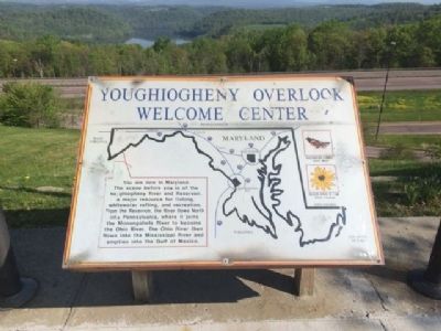
1. Youghiougheny Overlook Welcome Center Marker
You are now in Maryland. The scene before you is the Youghiougheny River and Reservoir, a major resource for fishing, whitewater rafting, and recreation. From the Reservoir, the River flows North into Pennsylvania, where it joins the Monongahela River to become the Ohio River. The Ohio River then flows into the Mississippi River and empties into the Gulf of Mexico.
Erected by the State of Maryland.
Topics. This historical marker is listed in these topic lists: Natural Features • Roads & Vehicles.
Location. Marker has been reported permanently removed. It was located near 39° 40.624′ N, 79° 22.532′ W. Marker was near Friendsville, Maryland, in Garrett County. It could be reached from Interstate 68 at milepost 6, 2.7 miles east of Friendsville Road (State Route 42). Located at the Youghiougheny Overlook rest area on I-68 Eastbound upper car parking spaces. Touch for map. Marker was at or near this postal address: 6172 National Fwy, Friendsville MD 21531, United States of America.
We have been informed that this marker is no longer there and will not be replaced.
this page online
Regionally, this marker was in Western Maryland. It was also in the American Mid-Atlantic, in Appalachia, and specifically in Northern Appalachia. Globally, it was in North America, the Western Hemisphere, the Western World, and the Anglosphere. Historically, it found itself in what was once one of the original Thirteen Colonies.

Other nearby markers. At least 8 other markers are within 2 miles of this location, measured as the crow flies: The Youghiogheny River (a few steps from this marker); At The Crossroads Of Conflict (within shouting distance of this marker); J.W. McCullough, Lumbering and Mining Titan (approx. 1.7 miles away); Friendsville Baseball Fever, Cider Mill, Shanty Town (approx. 1.7 miles away); Bear Creek Lumber and Meat Market (approx. 1.7 miles away); Vietnam Memorial (approx. 1.8 miles away); Walnut Street and First Avenue – F.G. Fox & Sons (approx. 1.8 miles away); Yough Motors, Confectionary and Bandstand (approx. 1.8 miles away). Touch for a list and map of all markers in Friendsville.
Other markers no longer nearby. The National Road (was within shouting
Photographed by Mark Hilton, May 11, 2015
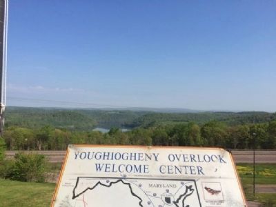
2. Marker and Reservoir in background.
Also see . . . Youghiogheny River Reservoir. Maryland Department of Natural Resources website entry (Submitted on May 23, 2015, by Mark Hilton of Montgomery, Alabama.)
Photographed by Mark Hilton, May 10, 2015
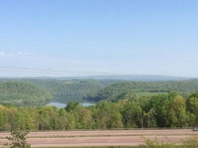
3. Youghiougheny Reservoir
Photographed by Devry Becker Jones (CC0), September 17, 2019
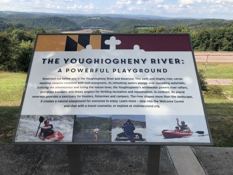
4. The Youghiogheny River: A Powerful Playground
This plaque has replaced the previous marker.
Credits. This page was last revised on August 12, 2026. It was originally submitted on May 23, 2015, by Mark Hilton of Montgomery, Alabama. This page has been viewed 471 times since then and 24 times this year. Photos: 1, 2, 3. submitted on May 23, 2015, by Mark Hilton of Montgomery, Alabama. 4. submitted on September 19, 2019, by Devry Becker Jones of Washington, District of Columbia.
