
Near Hollywood in Jackson County, Alabama — The American South (East South Central)
Bellefonte Cemetery
⎯⎯⎯
Town of Bellefonte
Photographed by Lee Hattabaugh, April 23, 2010
1. Bellefonte Cemetery / Town of Bellefonte Marker
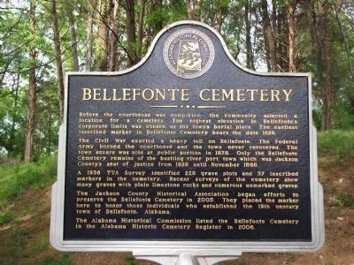
Bellefonte Cemetery
Before the courthouse was completed, the community selected a location for a cemetery. The highest elevation in Bellefonte's corporate limits was chosen as the town's burial place. The earliest inscribed marker in Bellefonte Cemetery bears the date 1826.
The Civil War exacted a heavy toll on Bellefonte. The Federal Army burned the courthouse and the town never recovered. The town square was sold at public auction in 1878. Only the Bellefonte Cemetery remains of the bustling river port town which was Jackson County's seat of justice from 1828 until November 1868.
A 1936 TVA Survey identified 229 grave plots and 57 inscribed markers in the cemetery. Recent surveys of the cemetery show many graves with plain limestone rocks and numerous unmarked graves.
The Jackson County Historical Association began efforts to preserve the Bellefonte Cemetery in 2005. They placed the marker here to honor those individuals who established the 19th century town of Bellefonte, Alabama.
The Alabama Historical Commission listed the Bellefonte Cemetery in the Alabama Historic Cemetery Register in 2006.
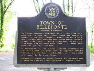
Town of Bellefonte
The
this page online
On December 15, 1821, the Alabama Legislature incorporated 60 acres in Bellefonte. Six years later, the Legislature extended Bellefonte's corporate limits to include 100 acres of land donated to the county by Carter and Higgins.
Bellefonte was selected as Jackson County's first permanent seat of justice and a two-story, brick courthouse was erected in 1828.
Erected 2007 by Jackson County Historical Association.
Topics. This historical marker is listed in these topic lists: Cemeteries & Burial Sites • Settlements & Settlers • War, US Civil. A significant historical date for this entry is November 25, 1868.
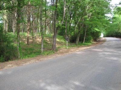
Location. 34° 42.76′ N, 85° 56.814′ W. Marker is near Hollywood, Alabama, in Jackson County. It is on Bellefonte Road
Photographed by Lee Hattabaugh, April 23, 2010
2. Bellefonte Cemetery / Town of Bellefonte Marker

Regionally, this marker is in North Alabama. It is also in the American South, specifically in the Deep South, in Appalachia, and specifically in Southern Appalachia. Globally, it is in North America, a Gulf of Mexico state, the Western Hemisphere, the Western World, and the Anglosphere. Historically, it finds itself in what was once the original Cherokee Nation, the territory of the Mississippian Culture, one of the Confederate States of America, and the Antebellum South.
Other nearby markers. At least 8 other markers are within 6 miles of this marker, measured as the crow flies: Old Baptist Cemetery (approx. 2 miles away); Robert Thomas and Elizabeth Scott, Sr. Memorial (approx. 5.2 miles away); Friendship Park / The Decision That Saved the Sons of Scottsboro (approx. 5.2 miles away); Robert Thomas Scott, Sr. / Robert Thomas Scott, Sr.
Photographed by Lee Hattabaugh, April 23, 2010
3. Bellefonte Cemetery / Town of Bellefonte Marker
Another marker is no longer nearby. First Baptist Church (was approx. 5.6 miles away but has been confirmed missing).
Additional commentary.
1. Old Martin Inn photos
The old Martin Inn chimney is approximately 0.2 miles East of the marker on County Rd 33. It is on the property of a local business and may not be accessible, but is easily viewed from the road.
— Submitted April 27, 2010, by Lee Hattabaugh of Capshaw, Alabama.
Photographed by Lee Hattabaugh, April 23, 2010
4. Bellefonte Cemetery / Town of Bellefonte Marker
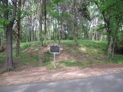
The cemetery is on the hill behind the marker.
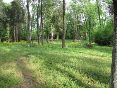
Photographed by Lee Hattabaugh, April 23, 2010
5. Bellefonte Cemetery
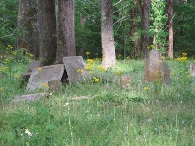
Photographed by Lee Hattabaugh, April 23, 2010
6. Bellefonte Cemetery
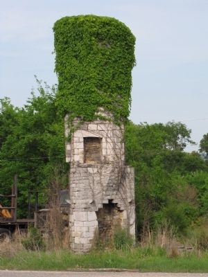
Photographed by Lee Hattabaugh, April 23, 2010
7. Old Martin Inn chimney
I've read that this is the chimney from the old Martin Inn and is the last remaining structure of the town of Bellefonte in the original location. "Built in 1815, the inn still stood in 1992, though in severe deterioration." I do not know when it was finally demolished.
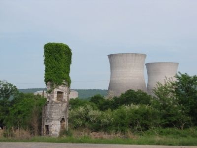
Photographed by Lee Hattabaugh, April 23, 2010
8. Old Martin Inn/Bellefonte nuclear power station
The Martin Inn was located on the Bellefonte town square. You can see in this picture the cooling towers at the TVA station.
Credits. This page was last revised on May 5, 2024. It was originally submitted on April 26, 2010, by Lee Hattabaugh of Capshaw, Alabama. This page has been viewed 4,136 times since then and 179 times this year. Last updated on May 28, 2015, by J. Makali Bruton of Washington, District of Columbia. Photos: 1, 2, 3, 4, 5, 6, 7, 8. submitted on April 26, 2010, by Lee Hattabaugh of Capshaw, Alabama. • Bill Pfingsten was the editor who published this page.
