Site of Fort McCord
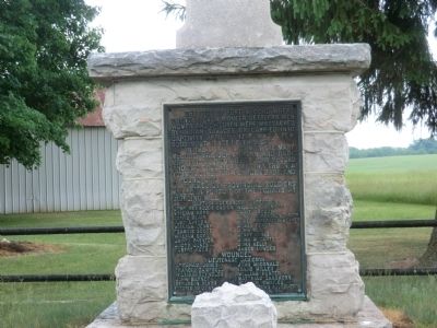
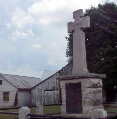
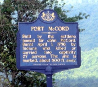
The site of Fort McCord where twenty-seven pioneer settlers men, women and children were massacred by Indian savages or carried into captivity, April 1st, 1756, was a few rods south east of this spot.
In the list of victims were Mary McCord, Mrs. John Thorn and babe, Mrs. Anne McCord wife of John McCord and two daughters Martha Thorn, a young mother with unborn babe, and a young girl.
Names of provincial soldiers killed in pursuit of the Indians at Sideling Hill:
Captain Alexander Culbertson John Reynolds Ensign William Chambers William Kerr Daniel McCoy James Blair James Robertson Tailor John Layson James Robertson Weaver William Denny James Peace Francis Scott John Blair William Boyd Henry Jones Jacob Jones John Kelly Robert Kerr James Lowder.
Wounded:
Lieutenant Jamieson Abraham Jones John McDonald Francis Campbell Isaac Miller William Reynolds William Hunter John Barnett Matthias Canshorn Benjamin Blyth William Swailes.
Erected 1914.
Topics. This historical marker is listed in these topic lists: Colonial Era • Native Americans • Settlements & Settlers • War, French and Indian. A significant historical date for this entry is April 1, 1767.
Location. 39° 59.094′ N, 77°
Other nearby markers. At least 8 other markers are within 6 miles of this marker, measured as the crow flies. Fort McCord (about 500 feet away, measured in a direct line); Joseph Armstrong (approx. 1.7 miles away); Colonel James G. Elder (approx. 4.8 miles away); St. Thomas Commemorates (approx. 4.8 miles away); Tree Pump(s) (approx. 4.8 miles away); Jacob Nelson "Nellie" Fox (approx. 4.9 miles away); Fort Wadell (approx. 5.7 miles away); Fort Waddell (approx. 5.7 miles away).
Credits. This page was last revised on February 7, 2023. It was originally submitted on June 2, 2015, by Don Morfe of Baltimore, Maryland. This page has been viewed 3,673 times since then and 985 times this year. Photos: 1, 2, 3. submitted on June 2, 2015, by Don Morfe of Baltimore, Maryland. • Bill Pfingsten was the editor who published this page.


