Shamokin Dam in Snyder County, Pennsylvania — The American Northeast (Mid-Atlantic)
Sunbury
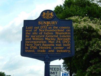
Photographed by Bill Pfingsten, June 15, 2015
1. Sunbury Marker
Erected by Pennsylvania Historical & Museum Commission.
Topics and series. This historical marker is listed in these topic lists: Colonial Era • Forts and Castles • Indigenous Peoples and Communities • Settlements & Settlers. In addition, it is included in the Pennsylvania Historical and Museum Commission (PHMC) series list. A significant historical date for this entry is March 24, 1884.
Location. 40° 50.928′ N, 76° 49.17′ W. Marker is in Shamokin Dam, Pennsylvania, in Snyder County. It is at the intersection of U.S. 11/15 and E. 8th Avenue on U.S. 11/15. Touch for map. Marker is in this post office area: Shamokin Dam PA 17876, United States of America. Touch for directions.

Regionally, this marker is in Pennsylvania’s Susquehanna Valley. It is also in the American Northeast, in the Mid-Atlantic, in Appalachia, and specifically in Northern Appalachia. Globally,
this page online
Other nearby markers. At least 8 other markers are within 2 miles of this marker, measured as the crow flies: A different marker also named Sunbury (approx. 0.9 miles away); a different marker also named Sunbury (approx. one mile away); Danville-Pottsville R.R. (approx. 1.4 miles away); First Electric Light (approx. 1½ miles away); Northumberland County (approx. 1.6 miles away); Beck House (approx. 1.6 miles away); Erected to the Memory of the World War Heroes (approx. 1.6 miles away); William Maclay (approx. 1.6 miles away).
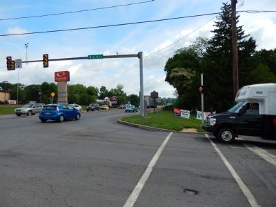
Photographed by Bill Pfingsten, June 15, 2015
2. Sunbury Marker
Marker is poorly located with no safe area to stop to read text.
Credits. This page was last revised on July 10, 2021. It was originally submitted on June 16, 2015, by Bill Pfingsten of Bel Air, Maryland. This page has been viewed 467 times since then and 28 times this year. Photos: 1, 2. submitted on June 16, 2015, by Bill Pfingsten of Bel Air, Maryland.
