Greer in Greenville County, South Carolina — The American South (South Atlantic)
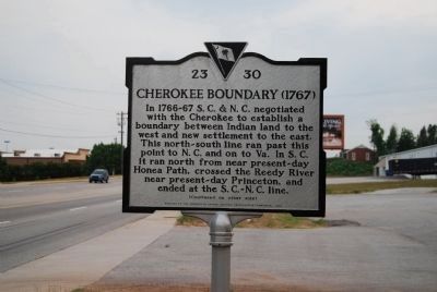
Cherokee Boundary (1767)
[Front]:
In 1766-67 S.C. & N.C. negotiated with the Cherokee to establish a boundary between Indian land to the west and new settlement to the east. This north-south line ran past this point to N.C. and on to Va. In S.C. it ran north from near present-day Honea Path, crossed the Reedy River near present-day Princeton, and ended at the S.C.-N.C. line.
[Reverse]:
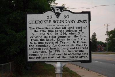
The Cherokee ceded all land east of the 1767 line to the colonies of S.C. and N.C. In 1786, when S.C. created its first counties, the line from the Reedy River to the S.C.-N.C. line south of Tryon, N.C. was the boundary for Greenville County between both Spartanburg and Laurens Counties. In 1793 the Greenville boundary shifted east to accommodate new settlers south of the Enoree River.
Erected 2005 by Greenville County Historical Preservation Commission. (Marker Number 23-30.)
Topics and series. This historical marker is listed in these topic lists: Colonial Era • Native Americans • Political Subdivisions • Settlements & Settlers. In addition, it is included in the South Carolina, Greenville County Historic Preservation Commission series list. A significant historical year for this entry is 1767.
Location. 34° 51.248′ N, 82° 13.683′ W. Marker is in Greer, South Carolina, in Greenville County. Marker is on South Highway 14 (State Highway 14), on the left when traveling north. Marker is located beside the A-1 Golf Cart Connection near the bridge crossing over the Enoree River. Touch for map. Marker is in this post office area: Greer SC 29650, United States of America. Touch for directions.
Other nearby markers. At least 10 other markers are within 5 miles of this marker, measured as the crow flies. Pelham Mill (approx. ¼ mile away); McClimons Memorial (approx. 2½ miles away); Hugh Porter & Jane Baily McClimon (approx. 2½ miles away); Graceland East Memorial Park Veterans Monument (approx. 3 miles away); Early White Settlement / The Massacre of Jacob Hite (approx. 3.2 miles away); Flatwood (approx. 3.4 miles away); Theron J. Hendrix Memorial Highway (approx. 4 miles away); Gilder (approx. 4½ miles away); Old Pilgrim Baptist Church / Old Pilgrim Rosenwald School (approx. 4.6 miles away); Fred W. Symmes Hall of Science (approx. 4.6 miles away). Touch for a list and map of all markers in Greer.
Related marker. Click here for another marker that is related to this marker.
Credits. This page was last revised on June 16, 2016. It was originally submitted on June 20, 2008, by Brian Scott of Anderson, South Carolina. This page has been viewed 2,005 times since then and 50 times this year. Photos: 1, 2. submitted on June 20, 2008, by Brian Scott of Anderson, South Carolina. • Kevin W. was the editor who published this page.

