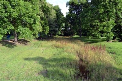
Delta in Madison Parish, Louisiana — The American South (West South Central)
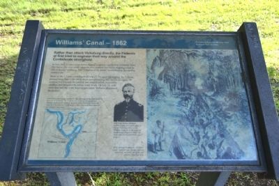
Williams' Canal – 1862
In June 1862, Union troops started digging a canal across the foot of DeSoto Point. The theory: the river would adopt the new channel, and Union shipping would be able to bypass Vicksburg. The “Gibraltar of the South” would become just another inland town.
Work on the 1.5 mile canal began on June 27. To speed the digging, the Federals pressed more than 1,200 blacks from area plantations into service alongside the soldiers. For a month the laborers and soldiers toiled, reduced by sickness and hampered by falling water levels. On July 24, with more than half the work force incapacitated, Williams abandoned the project.
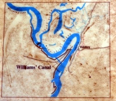
(Map Caption)
Most of the canal lay just beyond the effective range of the Confederate batteries at Vicksburg. The Confederates, however, constructed new batteries to fire on the mouth of the canal below Vicksburg. Even if the canal had been finished, Confederate artillery fire would have made its use extremely hazardous.
(Image Caption)
Brig. Gen. Thomas Williams, architect of the first Union effort to bypass Vicksburg with a canal. Williams would die at the battle of Baton Rouge (August 5, 1862) just weeks after he abandoned the canal project.
(Drawing Caption)
Black laborers working on “Williams’ Canal.” Laborers and soldiers suffered alike from sun stroke, diarrhea, and malaria. Hundreds died.
Erected by National Park Service.
Topics. This historical marker is listed in these topic lists: African Americans • War, US Civil • Waterways & Vessels. A significant historical month for this entry is June 1862.
Location. 32° 19.257′ N, 90° 55.985′ W. Marker is in Delta, Louisiana, in Madison Parish. Marker can be reached from the intersection of Old Highway 80 East and Stafford Drive, on the left when traveling south. Marker is located in the Grant’s Canal unit of the Vicksburg National Military Park; the above directions are to the parking lot. Touch for map. Marker is in this post office area: Delta LA 71233, United States of America. Touch for directions.
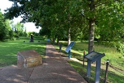
Other nearby markers. At least 8 other markers are within walking distance of this marker. U.S. Operations Against Vicksburg (here, next to this marker); Grant's Canal (here, next to this marker); Mississippi Sidestep (here, next to this marker); a different marker also named Grant's Canal (here, next to this marker); Grant's Canal – 1863 (a few steps from this marker); Freedmen Fight at Milliken's Bend (a few steps from this marker); U.S. African Brigade
(within shouting distance of this marker); Ninth Regiment Connecticut Volunteers (within shouting distance of this marker). Touch for a list and map of all markers in Delta.
Also see . . . Grant's Canal. From the National Park Service website for Vicksburg National Military Park. (Submitted on June 17, 2015.)
Credits. This page was last revised on June 16, 2016. It was originally submitted on June 17, 2015, by Duane Hall of Abilene, Texas. This page has been viewed 446 times since then and 13 times this year. Photos: 1, 2, 3, 4, 5. submitted on June 17, 2015, by Duane Hall of Abilene, Texas.
