Near Hohenwald in Lewis County, Tennessee — The American South (East South Central)
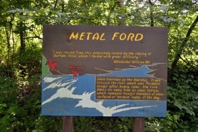
Metal Ford
“I was roused from this melancholy reverie by the roaring of Buffalo River, which I forded with great difficulty.”
Alexander Wilson, 1811
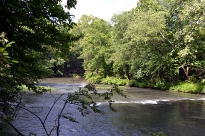
Here travelers on the Natchez Trace crossed the river which was fordable except after heavy rains. The ford takes its name from its stone bottom, which reminded frontier travelers of stone-surfaced or “metaled” roads of the day.
Erected by National Park Service.
Topics and series. This historical marker is listed in these topic lists: Roads & Vehicles • Waterways & Vessels. In addition, it is included in the Natchez Trace series list. A significant historical year for this entry is 1811.
Location. 35° 27.834′ N, 87° 28.761′ W. Marker is near Hohenwald, Tennessee, in Lewis County. Marker can be reached from Metal Ford Road, half a mile west of Natchez Trace Parkway. Marker is accessed at the Metal Ford turnoff from the Natchez Trace Parkway at Mile Marker 382.8; parking area for the marker is at the end of Metal Ford Road. Touch for map. Marker is in this post office area: Hohenwald TN 38462, United States of America. Touch for directions.
Other nearby markers. At least 8 other markers are within 6 miles of this marker, measured as the crow flies. Steele's Iron Works (within shouting distance of this marker); Meriwether Lewis: Life Compass (approx. 3.2 miles away); The Natchez Trace – Early American Trail (approx. 3.3 miles away); Grinder House (approx. 3.3 miles away); Natchez Trace (approx. 3.4 miles away); Meriwether Lewis (approx. 3.4 miles away); This Monument Marks The Old Natchez Trace (approx. 6 miles away); The Old Natchez Trace (approx. 6 miles away). Touch for a list and map of all markers in Hohenwald.
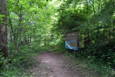
More about this marker. Marker is located next to the Buffalo River along the Steele’s Iron Works interpretive trail.
Also see . . . Natchez Trace. Official National Park Service website. (Submitted on June 24, 2015.)
Credits. This page was last revised on June 16, 2016. It was originally submitted on June 24, 2015, by Duane Hall of Abilene, Texas. This page has been viewed 642 times since then and 30 times this year. Photos: 1, 2, 3. submitted on June 24, 2015, by Duane Hall of Abilene, Texas.


