
Near Hearne in Milam County, Texas — The American South (West South Central)
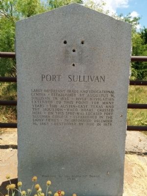
Port Sullivan
Photographed by Gregory Walker, June 10, 2015
1. Port Sullivan Marker
Erected 1936 by State of Texas. (Marker Number 7950.)
Topics and series. This historical marker is listed in these topic lists: Roads & Vehicles • Settlements & Settlers • Waterways & Vessels. In addition, it is included in the Texas 1936 Centennial Markers and Monuments series list. A significant historical year for this entry is 1835.
Location. 30° 52.545′ N, 96° 42.062′ W. Marker is near Hearne, Texas, in Milam County. It is on County Road 259 0.9 miles north of Farm to Market Road 485, on the right when traveling north. Touch for map. Marker is in this post office area: Cameron TX 76520, United States of America. Touch for directions.

Regionally, this marker is in the Prairies & Lakes Region. It is also in the American South. Globally, it is in North America,
this page online
Other nearby markers. At least 8 other markers are within 7 miles of this marker, measured as the crow flies: Port Sullivan Cemetery (approx. 0.6 miles away); Sugarloaf Bridge, Milam County (approx. 4.3 miles away); Sugarloaf Mountain (approx. 4.3 miles away); Site of the Town of Nashville (approx. 4½ miles away); DAR Centennial Park (approx. 4½ miles away); Camp Hearne World War II Prisoner of War Camp (approx. 4.9 miles away); Greater Riverside Cemetery (approx. 6.1 miles away); City of Hearne (approx. 6.2 miles away). Touch for a list and map of all markers in Hearne.
Also see . . . Port Sullivan article in Handbook of Texas. (Submitted on June 24, 2015, by Gregory Walker of La Grange, Texas.)
Photographed by Gregory Walker, June 10, 2015
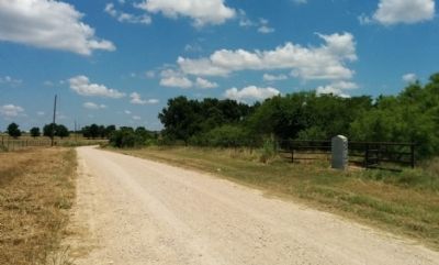
2. Port Sullivan Marker looking north on CR 259
Credits. This page was last revised on June 16, 2016. It was originally submitted on June 24, 2015, by Gregory Walker of La Grange, Texas. This page has been viewed 930 times since then and 37 times this year. Photos: 1, 2. submitted on June 24, 2015, by Gregory Walker of La Grange, Texas. • Bernard Fisher was the editor who published this page.
