Near Marlin in Falls County, Texas — The American South (West South Central)
Falls of the Brazos River
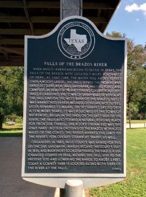
Photographed by Gregory Walker, June 10, 2015
1. Falls of the Brazos Marker
When Anglo-Americans began to settle in Texas, the falls of the Brazos were located 2 miles southwest of here. At that time, the water fell about 10 feet over a rocky ledge. The falls served the Indians and early settlers as a trail landmark, meeting point, and campsite. In 1834 colonizer Sterling C. Robertson (1785-1842) established the town of Sarahville de Viesca at the fall line of the west bank of the Brazos, but it was abandoned in 1836 because of Indian hostilities. Later renamed Ft. Milam, the settlement lasted only a few more years. It was followed by the town of Bucksnort, begun in the 1840s on the east side of the river. The falls also formed a natural fording place for frontier travel; the rocky stream bed was the only hard-bottom crossing of the Brazos within 200 miles of the coast. The rapids marked the limit of the river's 19th century steamboat traffic as well.
Organized in 1850, Falls County was named for this distinctive landmark. Marlin became the county seat in 1851, and Bucksnort soon disappeared. The Brazos River changed course in 1866, moving the Fall line to the present site and lowering the rapids
this page online
Erected 1975 by Texas Historical Commission. (Marker Number 1563.)
Topics. This historical marker is listed in these topic lists: Roads & Vehicles • Settlements & Settlers • Waterways & Vessels. A significant historical year for this entry is 1834.
Location. 31° 14.948′ N, 96° 55.236′ W. Marker is near Marlin, Texas, in Falls County. It can be reached from Farm to Market Road 712 west of County Road 301, on the left when traveling west. Located in Falls of the Brazos County Park. Park near the store building. Marker is in the playground south of the parking lot. Touch for map. Marker is at or near this postal address: 644 FM 712, Marlin TX 76661, United States of America. Touch for directions.

Regionally, this marker is in the Prairies & Lakes Region. Globally, it is in North America, a Gulf of Mexico state, the Western Hemisphere, the Western World, and the Anglosphere. Historically, it finds itself in what was once New Spain, the Republic of Texas, one of the Confederate States of America, and the Antebellum South.
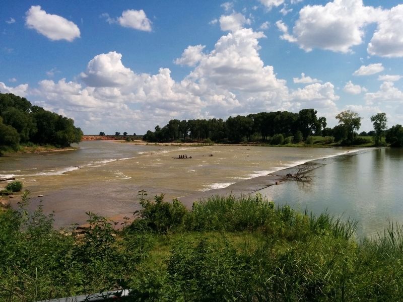
Photographed by Gregory Walker, July 13, 2017
2. Brazos River seen from Falls of the Brazos Park at normal flow.
Other nearby markers. At least 8 other markers are within 5 miles of this marker, measured as the crow flies: Site of Bucksnort (approx. 2.3 miles away); Old Settlers and Veterans Association of Falls County (approx. 3.7 miles away); The Rev. Nelson T. Denson and Marlin Missionary Baptist Church (approx. 3.9 miles away); Greater Providence Missionary Baptist Church (approx. 4 miles away); Falls County World War II Memorial (approx. 4.2 miles away); Falls County Courthouse (approx. 4.2 miles away); Journey of Faith: The 1867 South Carolina to Texas Migration (approx. 4.2 miles away); Marlin (approx. 4.3 miles away). Touch for a list and map of all markers in Marlin.
Also see . . . Falls County article in Handbook of Texas. The article describes the history of the area around the falls. (Submitted on June 24, 2015, by Gregory Walker of La Grange, Texas.)
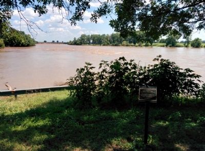
Photographed by Gregory Walker, June 10, 2015
3. Brazos River seen from Falls of the Brazos Park
The river is still in flood from the rains of Memorial Day weekend, 2015.
Credits. This page was last revised on August 23, 2024. It was originally submitted on June 24, 2015, by Gregory Walker of La Grange, Texas. This page has been viewed 5,006 times since then and 270 times this year. Photos: 1. submitted on June 24, 2015, by Gregory Walker of La Grange, Texas. 2. submitted on October 17, 2017, by Gregory Walker of La Grange, Texas. 3. submitted on June 24, 2015, by Gregory Walker of La Grange, Texas. • Bernard Fisher was the editor who published this page.
