Frostburg in Allegany County, Maryland — The American Northeast (Mid-Atlantic)
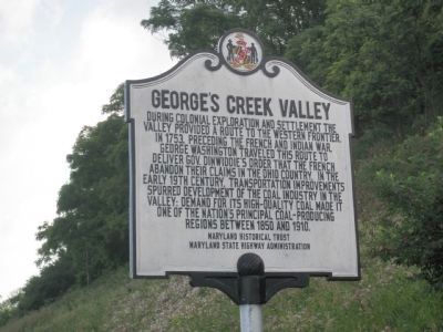
George's Creek Valley
Erected by Maryland Historical Trust, Maryland State Highway Adminstration.
Topics and series. This historical marker is listed in these topic lists: Exploration • Native Americans • Settlements & Settlers • War, French and Indian. In addition, it is included in the Maryland Historical Trust series list. A significant historical year for this entry is 1753.
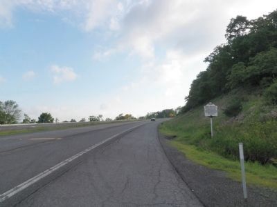
Location. 39° 38.169′ N, 78° 55.048′ W. Marker is in Frostburg, Maryland, in Allegany County. Marker is at the intersection of New Georges Creek Road (Maryland Route 36) and Hoffman Hollow Road, on the right when traveling north on New Georges Creek Road. Touch for map. Marker is in this post office area: Frostburg MD 21532, United States of America. Touch for directions.
Other nearby markers. At least 8 other markers are within 2 miles of this marker, measured as the crow flies. Veterans Memorial (approx. 1.1 miles away); World War I Memorial (approx. 1.1 miles away); a different marker also named Veterans Memorial (approx. 1.1 miles away); Martin’s Plantation (approx. 1.1 miles away); Fuller House (approx. 1.1 miles away); Pullen Hall (approx. 1.2 miles away); Performing Arts Center (approx. 1.2 miles away); Brady Health Center (approx. 1.2 miles away). Touch for a list and map of all markers in Frostburg.
Credits. This page was last revised on June 16, 2016. It was originally submitted on June 26, 2015, by Mike Wintermantel of Pittsburgh, Pennsylvania. This page has been viewed 840 times since then and 61 times this year. Photos: 1, 2. submitted on June 26, 2015, by Mike Wintermantel of Pittsburgh, Pennsylvania.

