Tupelo in Lee County, Mississippi — The American South (East South Central)
Old Town Creek
Photographed by Duane Hall, June 4, 2015
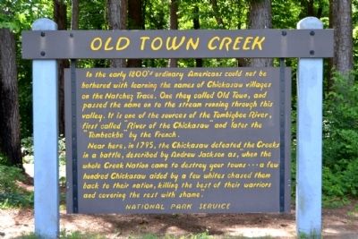
1. Old Town Creek Marker
Near here, in 1795, the Chickasaw defeated the Creeks in a battle, described by Andrew Jackson as, “when the whole Creek Nation came to destroy your towns ... a few hundred Chickasaw aided by a few whites chased them back to their nation, killing the best of their warriors and covering the rest with shame.”
Erected by National Park Service.
Topics and series. This historical marker is listed in these topic lists: Indigenous Peoples and Communities • Roads & Vehicles. In addition, it is included in the Former U.S. Presidents: #07 Andrew Jackson, and the Natchez Trace series lists. A significant historical year for this entry is 1795.
Location. 34° 18.256′ N, 88° 43.457′ W. Marker is in Tupelo, Mississippi, in Lee County. It can be
this page online

Regionally, this marker is in andspecifically ast Mississippi in the North Mississippi Hills. It is also in the American South and specifically in the Deep South. Globally, it is in North America, a Gulf of Mexico state, the Western Hemisphere, the Western World, and the Anglosphere. Historically, it finds itself in what was once the territory of the Mississippian Culture, one of the Confederate States of America, and the Antebellum South.
Other nearby markers. At least 8 other markers are within 3 miles of this marker, measured as the crow flies: Natchez Trace at Lee County (a few steps from this marker); Tupelo Campaign: Pontotoc Road, July 13 (approx. 0.8 miles away); Tupelo Campaign: Harrisburg July 14 (approx. 0.8 miles away); Tupelo Campaign: Old Town Creek, July 15 (approx. 0.8 miles away); Chickasaw Village Site (approx. 2 miles away); Carver School / Desegregation of Schools Across the South
Photographed by Duane Hall, June 4, 2015
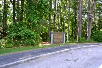
2. Old Town Creek Marker
Also see . . . Natchez Trace. Official National Park Service website. (Submitted on June 28, 2015.)
Photographed by Duane Hall, June 4, 2015
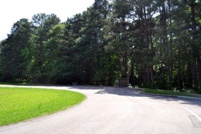
3. Old Town Creek Marker and D.A.R. Monument
from the Natchez Trace Parkway
Credits. This page was last revised on June 16, 2016. It was originally submitted on June 28, 2015, by Duane Hall of Abilene, Texas. This page has been viewed 1,102 times since then and 32 times this year. Photos: 1, 2, 3. submitted on June 28, 2015, by Duane Hall of Abilene, Texas.
