Lutherville-Timonium in Baltimore County, Maryland — The American Northeast (Mid-Atlantic)
Jones Falls Watershed
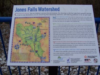
Congratulations! You are helping to protect the environment. By choosing to ride the Light Rail instead of driving a car to your destination, you are conserving fuel, decreasing emissions, and reducing pollutants in the air and water.
Many of the pollutants that impact our streams and reduce water quality come from gasoline-powered cars. The dirt and emissions from vehicles are deposited on the roadway and in the air. Each rain washes the contaminants directly to the stream. Pollutants from the streams also impact the water quality in the Chesapeake Bay.
The stream near this Light Rail station flows to the Gunpowder River. Much of the Light Rail line is adjacent to area streams. As you travel south from this station, you will see Roland Run and Lake Roland. These waterways flow to the Jones Falls river and eventually join the Inner Harbor and the Chesapeake Bay. Like the Bay, waters in the Jones Falls watershed are critical habitat for many species. Many of the streams in the Jones Falls watershed support trout. Trout are sensitive to pollution and are indicators of healthy streams and excellent water quality. Not all the streams in the Jones Falls are in such a healthy condition. Areas that are urbanized like Roland Run, suffer from erosion, increased runoff and an influx of pollutants. The resulting poor water quality and loss of habitat create conditions that will not support sensitive species like trout.
The State of Maryland ranks among the best places in the nation to live for protection of natural resources. Within the state, Baltimore County is one of the top counties focused on protecting the environment. Our streams, woodlands, and natural areas contribute to our quality of life and are assets worth protecting.
Thank you for taking Light Rail today and doing your part to protect the streams. If you would like to discover more ways to protect and restore our streams, or just want to learn more about watersheds, contact the Jones Falls Watershed Association, your local watershed association or Baltimore County.
Erected by Maryland Department of Transportation.
Topics. This historical marker is listed in these topic lists: Environment • Natural Resources • Railroads & Streetcars • Waterways & Vessels.
Location. 39° 26.891′ N, 76° 38.114′ W. Marker is in Lutherville-Timonium, Maryland, in Baltimore County. Marker can be reached from Ridgely Rd. Marker is in the Lutherville Light Rail station. Touch for map. Marker is in this post office area: Lutherville Timonium MD 21093, United States of America. Touch for directions.
Other nearby markers. At least 8 other markers are within walking distance of this marker. Baltimore & Susquehanna Railroad Marble Track Bed (within shouting distance of this marker); Baltimore and Susquehanna Railroad Marble Track Bed (about 300 feet away, measured in a direct line); White Marble Block (approx. 0.9 miles away); Property Boundary Marker (approx. 0.9 miles away); Millstone (approx. 0.9 miles away); Cornerstone from Wesley Chapel (approx. 0.9 miles away); Third and Last County Almshouse (approx. 0.9 miles away); Memorial to Marylanders-Liberation of Kuwait (approx. 0.9 miles away).
Also see . . . Jones Falls Watershed Organization. (Submitted on December 22, 2007, by Bill Pfingsten of Bel Air, Maryland.)
Credits. This page was last revised on March 21, 2020. It was originally submitted on December 22, 2007, by Bill Pfingsten of Bel Air, Maryland. This page has been viewed 2,752 times since then and 15 times this year. Last updated on June 22, 2008, by Wade L Fowble of Lutherville, Maryland. Photo 1. submitted on December 22, 2007, by Bill Pfingsten of Bel Air, Maryland. • J. J. Prats was the editor who published this page.
