
Womans Building
1910
| — | Architects: Thomas Bast • Contractors: R. F. Sellers & S. W. Ricketts | — |
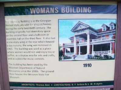
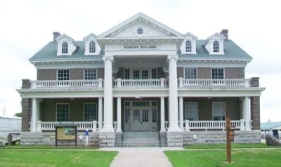
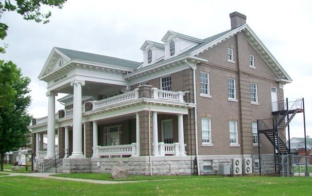
The Womans Building is in the Georgian Revival style, popular for elegant homes during the early twentieth century. The building originally had dormitory space on the second floor and a ballroom or assembly hall on the third floor. It also had a one-story wing at the rear which housed a day nursery; the wing was removed in 1965. The building was used as a place where women would rest and enjoy tea or coffee, as a display area for arts and crafts, and as a place for music concerts.
The building has been used by the Missouri Department of Natural Resources since the 1980s. The ground floor houses the Missouri State Fair Museum.
Erected by Missouri State Fair Commission.
Topics. This historical marker is listed in these topic lists: Agriculture • Entertainment • Women. A significant historical year for this entry is 1965.
Location. 38° 41.665′ N, 93° 15.477′ W. Marker is in Sedalia, Missouri, in Pettis County. It can be reached from Highway B. Marker and building are on the Missouri State Fairgrounds. Touch for map. Marker is at or near this postal address: 2503 West 16th Street, Sedalia MO 65301, United States
this page online

Regionally, this marker is in the Missouri River Corridor. It is also in the American Midwest, in the Lewis & Clark Corridor, in the Corn Belt, and on the Santa Fe Trail Corridor. Globally, it is in North America, the Western Hemisphere, the Western World, and the Anglosphere. Historically, it finds itself in what was once the territory of the Mississippian Culture, the Louisiana Purchase, and the Antebellum South.
Other nearby markers. At least 8 other markers are within walking distance of this marker: Historic Administration Building (about 300 feet away, measured in a direct line); Coliseum (about 300 feet away); Cattle Barns (about 500 feet away); Commercial Building (about 700 feet away); a different marker also named Cattle Barns (about 700 feet away); Family Fun Center (about 700 feet away); Home Economics Building (approx. 0.2 miles away); Varied Industries Building (approx. 0.2 miles away). Touch for a list and map of all markers in Sedalia.
Also see . . .
1. Missouri State Fairgrounds Historic District. National Register of Historic Places Registration Form (Submitted on July 5, 2015, by William Fischer, Jr. of Reynoldsburg, Ohio.)
2. Missouri State Fair History.
Credits. This page was last revised on December 10, 2025. It was originally submitted on July 5, 2015, by William Fischer, Jr. of Reynoldsburg, Ohio. This page has been viewed 393 times since then and 17 times this year. Photos: 1, 2, 3. submitted on July 5, 2015, by William Fischer, Jr. of Reynoldsburg, Ohio.
