Socastee in Horry County, South Carolina — The American South (South Atlantic)
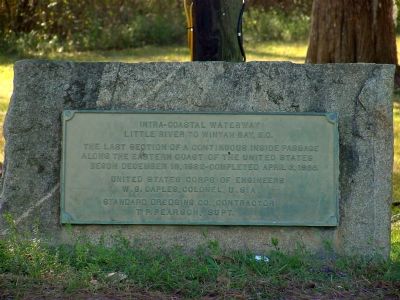
Intra-Coastal Waterway
Little River to Winyah Bay, S.C.
Photographed by J. J. Prats, February 8, 2007
1. Intra-Coastal Waterway Marker
United States Corps of Engineers, W.G. Caples, Colonel, U.S.A. • Standard Dredging Co., Contractor; T.P. Pearson, Supt.
Topics. This historical marker is listed in these topic lists: Man-Made Features • Waterways & Vessels. A significant historical date for this entry is December 19, 1932.
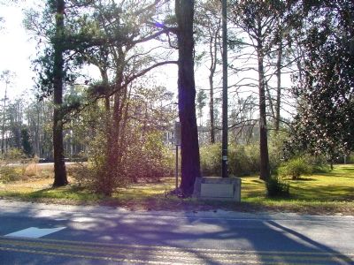
Location. 33° 41.274′ N, 79° 0.3′ W. Marker is in Socastee, South Carolina, in Horry County. It is on Dick Pond Road (former Highway 544) west of Socastee Boulevard (State Highway 707), on the right when traveling east. It faces the road just west of the swing bridge. Touch for map. Marker is in this post office area: Myrtle Beach SC 29575, United States of America. Touch for directions.

Regionally, this marker is on South Carolina’s Grand Strand and in the Pee Dee. It is also in the American South, specifically in the Deep South, and on the Eastern Seaboard. Globally, it is in the North Atlantic Region, North America, the Western Hemisphere, the Western World, and the Anglosphere. Historically,
this page online
Other nearby markers. At least 5 other markers are within 4 miles of this marker, measured as the crow flies: Socastee (about 400 feet away, measured in a direct line); The Sarvis House (about 700 feet away); Socastee Methodist Church (approx. 0.4 miles away); Command Chief Master Sergeant William D. Forbus (approx. 3.7 miles away); The Holocaust (approx. 3.8 miles away). Touch for a list and map of all markers in Socastee.
Photographed by J. J. Prats, February 8, 2007
2. Intra-Coastal Waterway Marker
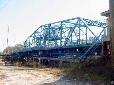
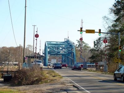
Socastee swing bridge is just to the left, still in service. South Carolina Route 544 crossed the Intracoastal Waterway here before the high 4-lane bridge was built. The new bridge can be seen through the trees.
Photographed by J. J. Prats, February 8, 2007
3. Socastee Swing Bridge
Photographed by J. J. Prats, February 8, 2007
4. Socastee Swing Bridge
Credits. This page was last revised on November 24, 2020. It was originally submitted on February 8, 2007, by J. J. Prats of Powell, Ohio. This page has been viewed 3,337 times since then and 33 times this year. Photos: 1, 2, 3, 4. submitted on February 8, 2007, by J. J. Prats of Powell, Ohio.
