The Great Square
Karl Stirner Arts Trail
— City of Easton, Pennsylvania —
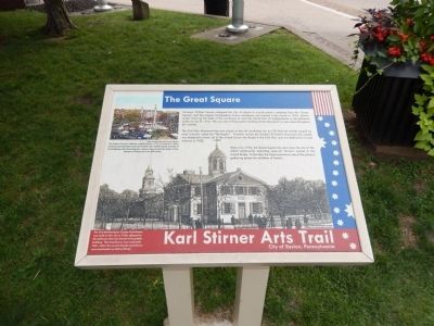
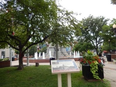
Surveyor William Parsons designated the City of Easton in a grid pattern radiating from this “Great Square” and the original Northampton County courthouse was erected in the square in 1765. Robert Levers stood on the steps of the courthouse to read the Declaration of Independence to the gathered public on July 8, 1776. This was one of three public readings of the documents to take place throughout the colonies.
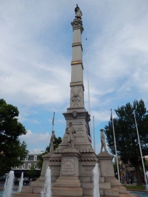
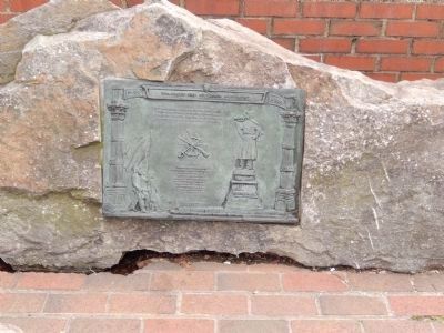
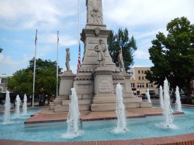
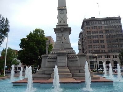
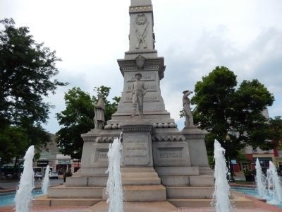
The Civil War Monument that now stands on the old courthouse site is a 75 foot tall obelisk topped by what is called the “Bugler.” Formally named the Soldiers’ and Sailors’ Monument, the obelisk was designed to honor all of the armed forces who fought in the Civil War and was dedicated to local veterans in 1900.
Since circa 1752, the Great Square has also been the site of the oldest continuously operating open-air farmer’s market in the United States. To this day, the Square serves as one of the primary gathering places for residents of Easton.
(Inscription under the image in the upper left)
The Easton Farmers’ Market, established in 1752, is America’s oldest continuously-operated open-air market. The market stands proudly in its birthplace, the Great Square, where it has served the needs of the people for Easton for over 250 years.
(Inscription under the image in the lower left)
Erected by City of Easton, Pennsylvania.
Topics and series. This historical marker is listed in these topic lists: Colonial Era • Industry & Commerce • War, US Civil • War, US Revolutionary. In addition, it is included in the Pennsylvania, Easton, Karl Stirner Arts Trail series list. A significant historical month for this entry is July 1804.
Location. 40° 41.471′ N, 75° 12.534′ W. Marker is in Easton, Pennsylvania, in Northampton County. Marker is on Center Square. Touch for map. Marker is in this post office area: Easton PA 18042, United States of America. Touch for directions.
Other nearby markers. At least 8 other markers are within walking distance of this marker. The Declaration of Independence in Easton (a few steps from this marker); Soldiers and Sailors Monument (a few steps from this marker); a different marker also named Soldiers and Sailors Monument (within shouting distance of this marker); Founding of Easton and Northampton County (within shouting distance of this marker); Indian Peace Treaties (within shouting distance of this marker); Northampton County’s First Court House (within shouting distance of this marker); Sullivan’s March (within shouting distance of this marker); Lafayette College Founding (within shouting distance of this marker). Touch for a list and map of all markers in Easton.
Credits. This page was last revised on October 4, 2020. It was originally submitted on July 26, 2015, by Don Morfe of Baltimore, Maryland. This page has been viewed 380 times since then and 31 times this year. Photos: 1, 2, 3, 4, 5, 6, 7. submitted on July 26, 2015, by Don Morfe of Baltimore, Maryland. • Bill Pfingsten was the editor who published this page.
