Kreidersville in Northampton County, Pennsylvania — The American Northeast (Mid-Atlantic)
Walking Purchase

Photographed by Laura Klotz, circa 2021
1. Walking Purchase Marker
Erected 1948 by Pennsylvania Historical & Museum Commission.
Topics and series. This historical marker is listed in these topic lists: Colonial Era • Government & Politics • Indigenous Peoples and Communities • Settlements & Settlers. In addition, it is included in the Pennsylvania Historical and Museum Commission (PHMC) series list. A significant historical year for this entry is 1737.
Location. 40° 43.278′ N, 75° 30.276′ W. Marker is in Kreidersville, Pennsylvania, in Northampton County. It is at the intersection of Indian Trail Rd. (SR 3016) and Kohls Road on Indian Trail Rd. (SR 3016). Touch for map. Marker is in this post office area: Northampton PA 18067, United States of America. Touch for directions.

Regionally, this marker is in Southeast Pennsylvania and in Lehigh Valley. It is also in the American Northeast and in the Mid-Atlantic. Globally, it is in North
this page online
Other nearby markers. At least 8 other markers are within 3 miles of this marker, measured as the crow flies: The Famous Indian Walk (a few steps from this marker); Veterans Memorial (approx. 0.2 miles away); The Mills of Allen Township (approx. 0.2 miles away); From Rails to Trails (approx. 1.1 miles away); Exploring the Corridor (approx. 1.1 miles away); Hockendauqua Indian Town (approx. 2 miles away); World War Memorial (approx. 2.1 miles away); Colonel John Siegfried (approx. 2.1 miles away).
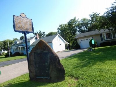
Photographed by Don Morfe, July 20, 2015
2. Walking Purchase Marker
Credits. This page was last revised on August 12, 2025. It was originally submitted on July 26, 2015, by Don Morfe of Baltimore, Maryland. This page has been viewed 1,257 times since then and 105 times this year. Photos: 1. submitted on September 14, 2024, by Laura Klotz of Northampton, Pennsylvania. 2. submitted on July 26, 2015, by Don Morfe of Baltimore, Maryland. • Bill Pfingsten was the editor who published this page.
Editor’s want-list for this marker. Close up of marker. Careful: there may be three different markers with same title and text in 3 different locations • Can you help?
