Near Manassas in Prince William County, Virginia — The American South (Mid-Atlantic)
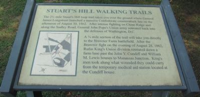
Stuart's Hill Walking Trail
A ¾ mile section of the trail will take you directly to the Brawner Farm battlefield. After the Brawner fight on the evening of August 28, 1862, Rufus King's Union division retreated down a farm lane past the John Y. Cundiff and William M. Lewis houses to Manassas Junction. King's men took along what wounded they could carry from the temporary medical aid station located at the Cundiff house.
Topics. This historical marker is listed in this topic list: War, US Civil. A significant historical year for this entry is 1862.
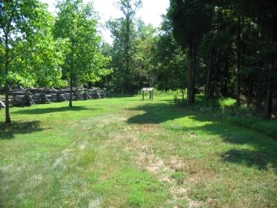
Location. 38° 48.3′ N, 77° 34.17′ W. Marker is near Manassas, Virginia, in Prince William County. Marker can be reached from Pageland Lane (County Route 705) 0.2 miles south of Lee Highway (U.S. 29), on the right when traveling north. Located at the Stuart Hill Center, in the western side of Manassas National Battlefield Park. The marker serves as the trail head for the Stuart's Hill Walking Trail. Touch for map. Marker is in this post office area: Manassas VA 20109, United States of America. Touch for directions.
Other nearby markers. At least 8 other markers are within walking distance of this marker. The Battlefield In 1862 (within shouting distance of this marker); Stuart's Hill (about 400 feet away, measured in a direct line); The Battle Begins (about 500 feet away); Meadowville (approx. ¼ mile away); Dunklin Monument (approx. ¼ mile away); Lee, Longstreet and Jackson Meeting (approx. half a mile away); Archeology at Brawner Farm (approx. 0.6 miles away); A Stand Up Fight (approx. 0.6 miles away). Touch for a list and map of all markers in Manassas.
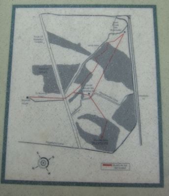
More about this marker. On the lower left is a map of the walking trail, with key points mentioned in the text indicated.
Credits. This page was last revised on April 9, 2022. It was originally submitted on August 3, 2008, by Craig Swain of Leesburg, Virginia. This page has been viewed 2,144 times since then and 22 times this year. Last updated on July 26, 2015, by J. Makali Bruton of Accra, Ghana. Photos: 1, 2. submitted on August 28, 2012, by Craig Swain of Leesburg, Virginia. 3. submitted on August 3, 2008, by Craig Swain of Leesburg, Virginia. • Bill Pfingsten was the editor who published this page.


