Springfield Township near Hellertown in Bucks County, Pennsylvania — The American Northeast (Mid-Atlantic)
Walking Purchase
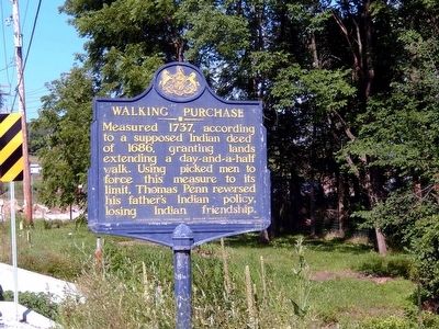
Photographed by Don Morfe, July 20, 2015
1. Walking Purchase Marker
Erected 1949 by Pennsylvania Historical & Museum Commission.
Topics and series. This historical marker is listed in these topic lists: Colonial Era • Government & Politics • Indigenous Peoples and Communities. In addition, it is included in the Pennsylvania Historical and Museum Commission (PHMC) series list. A significant historical year for this entry is 1737.
Location. 40° 32.758′ N, 75° 18.215′ W. Marker is near Hellertown, Pennsylvania, in Bucks County. It is in Springfield Township. It is on Hellertown Road (Pennsylvania Route 412). Touch for map. Marker is at or near this postal address: 2610 Hellertown Road, Springtown PA 18081, United States of America. Touch for directions.

Regionally, this marker is in Southeast Pennsylvania and in Greater Philadelphia. It is also in the American Northeast and in the Mid-Atlantic. Globally, it is in North America, the Western
this page online
Other nearby markers. At least 8 other markers are within 3 miles of this marker, measured as the crow flies: Luncheon Site (within shouting distance of this marker); Cpl. Charles C. Seifert (approx. 2.6 miles away); Joseph J. Beyer (approx. 2.6 miles away); Saucon Valley Veterans Memorial (approx. 2.6 miles away); War Memorial (approx. 2.6 miles away); Ehrharts Mill Historic District (approx. 2.6 miles away); 173 Main Street (approx. 2.7 miles away); Reverend Samuel Hess House (approx. 2.8 miles away). Touch for a list and map of all markers in Hellertown.
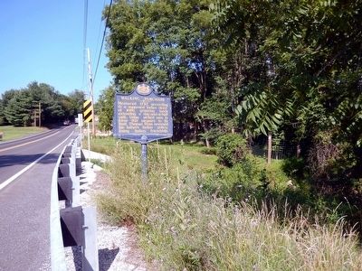
Photographed by Don Morfe, July 20, 2015
2. Walking Purchase Marker
Credits. This page was last revised on February 7, 2023. It was originally submitted on July 27, 2015, by Don Morfe of Baltimore, Maryland. This page has been viewed 1,521 times since then and 147 times this year. Photos: 1, 2. submitted on July 27, 2015, by Don Morfe of Baltimore, Maryland. • Bill Pfingsten was the editor who published this page.
