Rockleigh in Bergen County, New Jersey — The American Northeast (Mid-Atlantic)
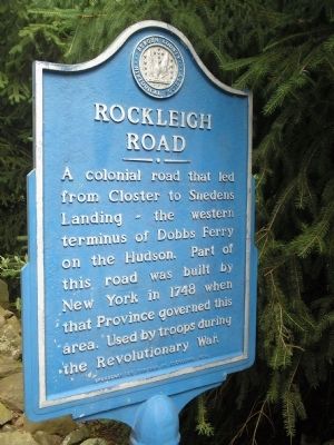
Rockleigh Road
A colonial road that led from Closter to Snedens Landing – the western terminus of Dobbs Ferry on the Hudson. Part of this road was built by New York in 1748 when that Province governed this area. Used by troops during the Revolutionary War.
Erected 1974 by Borough of Rockleigh. (Marker Number 48.)
Topics and series. This historical marker is listed in these topic lists: Colonial Era • Roads & Vehicles • War, US Revolutionary. In addition, it is included in the New Jersey, Bergen County Historical Society series list. A significant historical year for this entry is 1748.
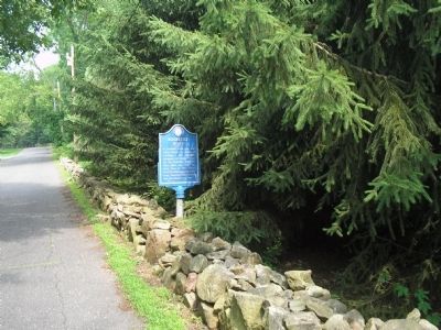
Location. 40° 59.924′ N, 73° 55.822′ W. Marker is in Rockleigh, New Jersey, in Bergen County. Marker is at the intersection of Rockleigh Road and Piermont Road (County Route 501), on the right when traveling north on Rockleigh Road. Touch for map. Marker is in this post office area: Northvale NJ 07647, United States of America. Touch for directions.
Other nearby markers. At least 8 other markers are within walking distance of this marker. Abraham A. Haring House (about 500 feet away, measured in a direct line); John A. Haring House (approx. 0.2 miles away); Jacob Concklin House (approx. 0.4 miles away); Rockleigh (approx. 0.4 miles away); Joseph Dubois House (approx. half a mile away); Piermont Road (approx. 0.7 miles away); Palisades Historic District (approx. 0.8 miles away in New York); Skunk Hollow (approx. one mile away in New York). Touch for a list and map of all markers in Rockleigh.
Also see . . . Bergen County Historical Society. Society website homepage (Submitted on June 29, 2008, by Bill Coughlin of Woodland Park, New Jersey.)
Credits. This page was last revised on December 12, 2021. It was originally submitted on June 29, 2008, by Bill Coughlin of Woodland Park, New Jersey. This page has been viewed 1,054 times since then and 11 times this year. Photos: 1, 2. submitted on June 29, 2008, by Bill Coughlin of Woodland Park, New Jersey.

