Mammoth in Yellowstone National Park in Park County, Wyoming — The American West (Mountains)
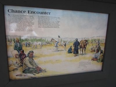
Chance Encounter
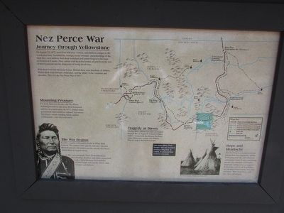
Nez Perce War
Across the meadow, a fire burned in the campsite of nine tourists on the night of August 23, 1877. The Cowan party had unknowingly camped near hundreds of Nez Perce men, women, and children who were under violent pursuit by the United States Army. Through the darkness, the Cowan’s firelight flickered and was spotted by Hemene Moxmox (Yellow Wolf) and other Nez Perce scouts. With the heightened instincts of war-torn hearts, the scouts entered the camp at daybreak. They dared not risk the Army learning the whereabouts of their people. Instead of taking chances, they took the tourists with them.
The coming hours revealed human emotions found in any war: fear, anger, and compassion. A Nez Perce leader, Wa-wook-ke-ya Was Sauw (Lean Elk), released the campers with a warning to stay hidden, but the small group was later overtaken. This time tempers flared. George Cowan was shot and left for dead, but eventually made a full recovery. Others sustained shots or escaped. Emma Cowan and her siblings were released unharmed the following day.
< Reverse Side : >
Nez Perce War
Journey through Yellowstone
On August 23, 1877, more than 600 men, women, and children camped in the woods near here. Sustained by courage, social structure, and knowledge of the land, they were midway from their homeland in Eastern Oregon to the hope of freedom in Canada. They carried with them the burden of grief from the loss of their homeland and the sharp pain of losing loved ones.
With them were two thousand horses. Behind them were hundreds of soldiers. Within them were strength, endurance, and the ability to face enemies and atrocities. This was the Nez Perce War of 1877.
Mounting Pressure
For more than two decades, the Nez Perce endured pressure to sign away their homeland and live on a reservation. In 1877, United States government representatives ordered “non-treaty” Nez Perce – bands standing firmly against confinement – onto the reservation.
The War Begins
Conflict erupted, followed by battle in White Bird Canyon. The soldiers were quickly defeated. General Howard arrived with reinforcements, but the Nez Perce eluded them in rugged terrain.
As the war continued, Chief Toohoolhoolzote, Five Wounds, Rainbow and others strategized tactics, Chief Heinmot Tooyalakeket (Chief Joseph, left) led the elderly men, women, and children.
Tragedy at Dawn
The Nez Perce gained many miles on General Howard. But on August 9th, Colonel Gibbon’s soldiers swooped into the sleeping Nez Perce camp, killing men, women, and children. Warriors leapt to defend their people.
Like Many others, Chief Joseph’s wife was wounded severely at Big Hole. In combat, he protected their newborn in his arms.
Hope and Heartache
The Nez Perce out-maneuvered and battled their foes repeatedly, upheld both young and old, and withstood unthinkable losses. Under unrelenting pursuit, they traveled 1,170 miles, eventually falling short on supplies. In the bitter cold of late September, just 40 miles from Canada, they were overtaken. With hearts heavy and torn, they surrendered.
Topics and series. This historical marker is listed in these topic lists: Native Americans • Wars, US Indian. In addition, it is included in the The Nez Perce Trail series list. A significant historical year for this entry is 1877.
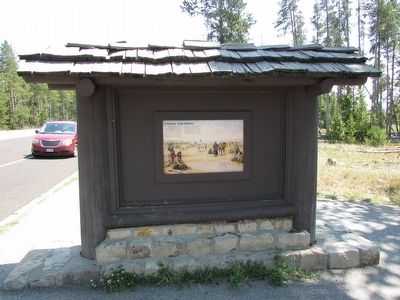
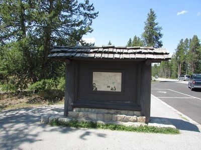
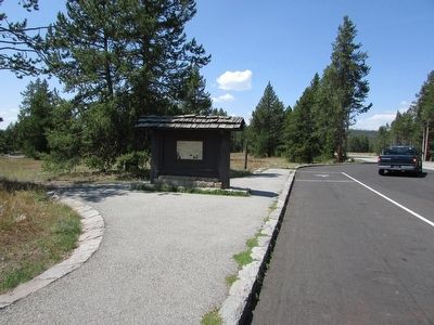
Location. 44° 34.444′ N, 110° 49.372′ W. Marker is in Yellowstone National Park, Wyoming, in Park County. It is in Mammoth. Marker is on Lower Grand Loop Road (U.S. 20), on the right when traveling south. Marker is located on the lower Grand Loop road in Yellowstone National Park, between the Madison and Old Faithful junctions. Touch for map. Marker is in this post office area: Yellowstone National Park WY 82190, United States of America. Touch for directions.
Other nearby markers. At least 8 other markers are within 3 miles of this marker, measured as the crow flies. Nez Perce War (here, next to this marker); a different marker also named Chance Encounter (here, next to this marker); Captive Tourists (here, next to this marker); Murky Past . . . Promising Future (approx. ¾ mile away); Earthquake’s Offspring (approx. 1.8 miles away); Fountain Paint Pot (approx. 1.8 miles away); a different marker also named Fountain Paint Pot (approx. 1.8 miles away); White Dome Geyser (approx. 2.6 miles away). Touch for a list and map of all markers in Yellowstone National Park.
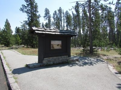
More about this marker. The background of the Chance Encounter side of the marker contains a picture of a Nez Perce encampment. It has a caption of “On a summer night in 1877, hundreds of ‘non-treaty’ Nez Perce – bands refusing confinement on a reservation – camped near here. They journeyed 1,170 miles (1,883 km) in their quest for freedom.”
The Nez Perce War side of the marker contains a map showing the route taken by the Nez Perce from Oregon territory to their final position just south of the Canadian border. It also shows their pursuit by the soldiers, and the sites of several encounters between the two groups.
Also see . . . The Nez Perce War. (Submitted on August 7, 2015, by Bill Coughlin of Woodland Park, New Jersey.)
Credits. This page was last revised on February 16, 2023. It was originally submitted on August 7, 2015, by Bill Coughlin of Woodland Park, New Jersey. This page has been viewed 506 times since then and 18 times this year. Photos: 1, 2, 3, 4, 5, 6. submitted on August 7, 2015, by Bill Coughlin of Woodland Park, New Jersey.
