Crow Agency in Big Horn County, Montana — The American West (Mountains)
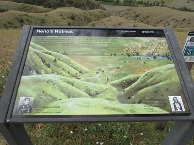
Reno’s Retreat
Little Bighorn Battlefield
Photographed by Bill Coughlin, July 23, 2015
1. Reno’s Retreat Marker
Under mounting pressure, Reno abandons the timber. His retreat disintegrates into a rout as pursuing warriors ride in amongst the troopers killing more than 30 soldiers. Indian casualties are few. Lakota and Cheyennes drive the cavalry across the river and up the steep bluffs to your left. Receiving word of other soldiers downstream (to your right) they abandon Reno to meet the new threat to their village.
“We’ve had a big fight in the bottom, got whipped like hell and I am damned glad to see you!”
“The Sioux and the Cheyennes charged and the troops ran for the river. The Indians rode right up to them and knocked some off their horses as they were running, and some fell off in the river. It was like chasing buffalo . . . a grand chase.”
Erected by National Park Service.
Topics. This historical marker is listed in these topic lists: Indigenous Peoples and Communities • Wars, US Indian.
Location. 45° 31.554′ N, 107° 23.011′ W. Marker is in Crow Agency, Montana, in
this page online

Regionally, this marker is in Montana’s and he Crow Nation, in Southeast Montana, in Custer Country. It is also in the American Mountain West, in the Lewis & Clark Corridor, on the prairies, on the Great Plains, and specifically on the Northern Plains. Globally, it is in North America, the Rocky Mountains, the Western Hemisphere, the Western World, and the Anglosphere. Historically, it finds itself in what was once Rupert’s Land and also the Louisiana Purchase.
Other nearby markers. At least 8 other markers are within walking distance of this marker: Reno’s Valley Fight (here, next to this marker); Custer’s Advance (a few steps from this marker); Reno's Skirmish Line - Warrior Counterattack (about 400 feet away, measured in a direct line); Retreat Crossing (about 400 feet away); Timber Fight (about 400 feet away);
Photographed by Bill Coughlin, July 23, 2015
2. Reno’s Retreat Marker
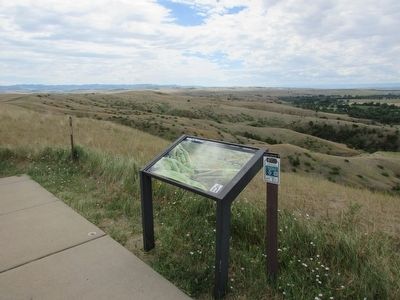
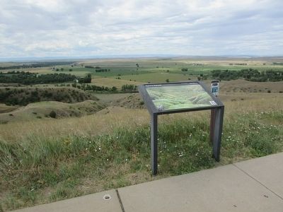
More about this marker. The background of the marker contains a picture of the Indians chasing Reno’s men across the river and up the bluffs.
Also see . . . The Battle of the Little Bighorn, 1876. (Submitted on August 7, 2015, by Bill Coughlin of Woodland Park, New Jersey.)
Photographed by Bill Coughlin, July 23, 2015
3. Marker on the Little Bighorn Battlefield
Photographed by Bill Coughlin, July 23, 2015
4. Site of Reno’s Retreat
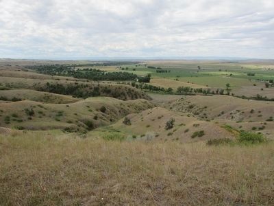
Reno's cavalry retreated across the river and up the hill seen here.
Credits. This page was last revised on June 16, 2016. It was originally submitted on August 7, 2015, by Bill Coughlin of Woodland Park, New Jersey. This page has been viewed 2,103 times since then and 199 times this year. Photos: 1, 2, 3, 4. submitted on August 7, 2015, by Bill Coughlin of Woodland Park, New Jersey.
