Homewood in Cook County, Illinois — The American Midwest (Great Lakes)
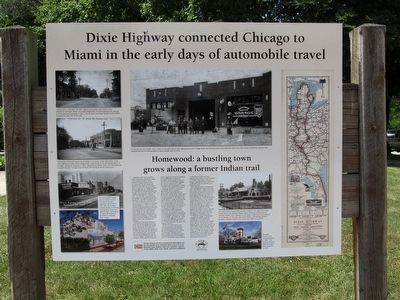
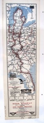
Dixie Highway connected Chicago to Miami in the early days of automobile travel
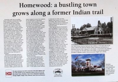
Homewood: a bustling town grows along a former Indian trail
Photographed by Paul Fehrenbach, August 7, 2015
1. Dixie Highway Marker
Settlements developed along the route with the first residents arriving in this area in the 1830s and 1840s to farm the fertile soil. James Hart platted Hartford as the first subdivision in 1853 the same year the first
this page online
By 1915 automobile travel became increasingly popular for business, agricultural, and recreational uses. Citizens demanded that the government provide better roads, which at this time consisted primarily of dirt and were passible in fair weather, yet quickly became muddy and impassible after a few hours of rain. Governors from several states met to consider an improved road from Indianapolis to Florida. States lobbied for inclusion, so instead of a single route, two major divisions were designated. Carl Fisher, a civic booster, an auto enthusiast instrumental in developing the Indianapolis Motor Speedway, a Florida land developer, and called the “Father of the Lincoln Highway,” convinced the governors that Chicago should be the northern terminus. The great Dixie Highway was born.
By the turn of the century,
Photographed by Paul Fehrenbach, August 7, 2015
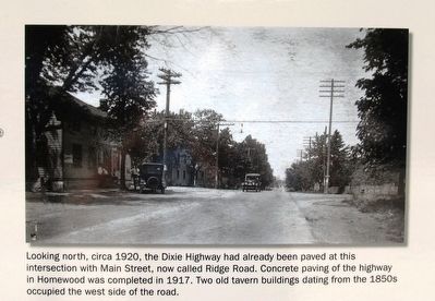
2. Dixie Highway Marker - Upper left photo
Looking north, circa 1920, the Dixie Highway had already been paved at this intersection with Main Street, now called Ridge Road. Concrete paving of the highway in Homewood was completed in 1917. Two old tavern buildings dating from the 1850s occupied the west side of the road.
Dixie Highway became Homewood’s main thoroughfare. A white frame two-room school built in 1880 now houses businesses and apartments just north of this sign. Next to the building is a Dixie Highway mileage sign post. On this site known as Independence Park, a four-room, two-story brick building named Standard School was built in 1904. An underpass was constructed under Dixie Highway so students could cross the highway safely. The Homewood village Hall, at Dixie Highway and Chestnut Road, was built with the aid of PWA funds and was dedicated in September 1939. It is considered an architectural gem.
In 1998 the Village of Homewood Heritage Committee sought the cooperation of the Illinois Dixie Communities
Photographed by Paul Fehrenbach, August 7, 2015
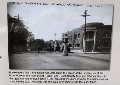
3. Dixie Highway Marker - center left photo
Homewood’s first traffic signal was installed in the center of the intersection of the Dixie Highway and Main Street (Ridge Road). Cook County Trust and Savings Bank, on the right, opened for business in 1925, replacing the pioneer tavern that had previously occupied the site. The signal was removed after being struck too many times.
Erected 2015 by A's R US Model A Ford Car Club.
Topics and series. This historical marker is listed in these topic lists: Indigenous Peoples and Communities • Railroads & Streetcars • Roads & Vehicles • Settlements & Settlers. In addition, it is included in the Former U.S. Presidents: #16 Abraham Lincoln series list. A significant historical month for this entry is July 1827.
Location. 41° 33.608′ N, 87° 39.932′ W. Marker is in Homewood, Illinois, in Cook County. It is at the intersection of Dixie Highway and Hickory Road, on the right when traveling south on Dixie Highway. Marker is located at the entrance to Independence Park. Touch for map. Marker is at or near this postal address: 18120 Dixie Hwy, Homewood IL 60430, United States of America. Touch for directions.

Regionally,
Photographed by Paul Fehrenbach, August 7, 2015
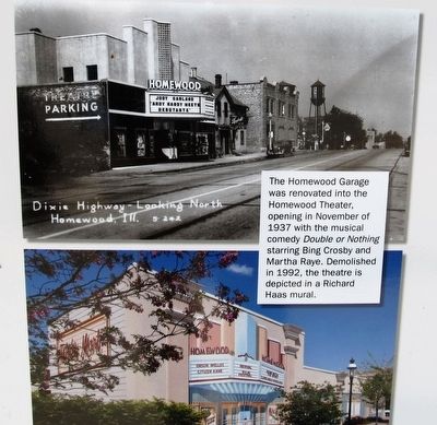
4. Dixie Highway Marker - lower left photo
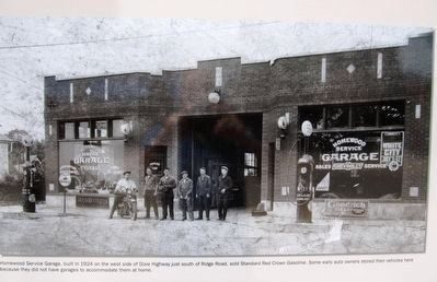
The Homewood Garage was renovated into the Homewood Theater, opening in November of 1937 with the musical comedy Double of Nothing starring Bing Crosby and Martha Raye. Demolished in 1992, the theatre is depicted in a Richard Haas mural.
Other nearby markers. At least 8 other markers are within 5 miles of this marker, measured as the crow flies: Dixie Highway (here, next to this marker); Washington Park Racetrack (approx. 1.3 miles away); Markham Prairie (approx. 3.3 miles away); Markham Veterans Memorial (approx. 3.4 miles away); Camp Thornton #2605 and the Civil Conservation Corps (approx. 3½ miles away); Site of Absolem Wells Cabin (approx. 3.8 miles away); Chicago Heights (approx. 4.1 miles away); Veterans Memorial Flag Pole (approx. 4.7 miles away). Touch for a list and map of all markers in Homewood.
Photographed by Paul Fehrenbach, August 7, 2015
5. Dixie Highway Marker - center right photo
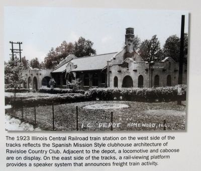
The 1923 Illinois Central Railroad train station on the west side of the tracks reflects the Spanish Mission Style clubhouse architecture of the Ravisloe Country Club. Adjacent to the depot, a locomotive and caboose are on display. On the east side of the tracks, a rai-viewing platform provides a speaker system that announces freight train activity.
Photographed by Paul Fehrenbach, August 7, 2015
6. Dixie Highway Marker - lower right photo
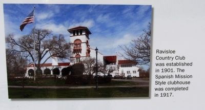
Ravisloe Country Club was established in 1901. The Spanish Mission Style clubhouse was completed in 1917.
Photographed by Paul Fehrenbach, August 7, 2015
7. Dixie Highway Marker
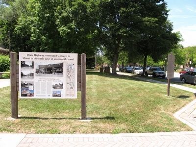
with nearby state Dixie Highway marker in the background
Photographed by Paul Fehrenbach, August 7, 2015
8. Dixie Highway Marker
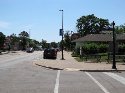
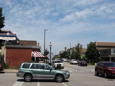
looking south along Dixie Highway
Photographed by Paul Fehrenbach, August 7, 2015
9. Dixie Highway Marker
looking north along Dixie Highway
Photographed by Paul Fehrenbach, August 7, 2015
10. Dixie Highway Marker
close-up of text area
Photographed by Paul Fehrenbach, August 7, 2015
11. Dixie Highway marker
close-up of inset map
Photographed by Paul Fehrenbach, August 7, 2015
12. Dixie Highway Marker Center Photo
Homewood Service Garage, built in 1924 on the west side of Dixie Highway just south of Ridge Road, sold Standard Red Crown Gasoline. Some early auto owners stored their vehicles here because they did not have garages to accommodate them at home.
Credits. This page was last revised on June 1, 2025. It was originally submitted on August 12, 2015, by Paul Fehrenbach of Richfield, Wisconsin. This page has been viewed 1,267 times since then and 84 times this year. Photos: 1, 2, 3, 4, 5, 6, 7, 8, 9, 10, 11, 12. submitted on August 12, 2015, by Paul Fehrenbach of Richfield, Wisconsin. • Bill Pfingsten was the editor who published this page.
