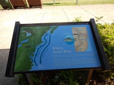
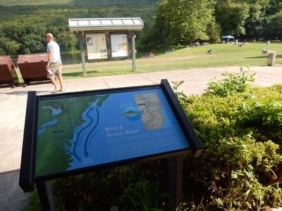
Wild & Scenic River
Delaware Water Gap National Recreation Area
— Smithfield Beach —
Congress designated the Middle Delaware National Scenic and Recreational River in 1978. The Wild and Scenic Rivers Act preserves rivers throughout the United States for their wild, scenic, and recreational attributes. Designated rivers must be free-flowing and have excellent water quality. These qualities of the Middle Delaware protect clean drinking water, maintain high ecological integrity, and ensure superior recreational experiences.
(Inscription in the upper left corner)
The defeat of the Tocks Island Dam in 1975 was an early victory for the environmental movement.
(Inscription in the upper right)
American shad can freely migrate up the Delaware River from the bay in spring.
Erected by National Park Service-United States Department of the Interior.
Topics. This historical marker is listed in these topic lists: Animals • Environment • Waterways & Vessels. A significant historical year for this entry is 1978.
Location. 41° 1.739′ N, 75° 3.151′ W. Marker is in Bushkill, Pennsylvania, in Pike County. Marker is on River Road (CR 2028)
Other nearby markers. At least 8 other markers are within 3 miles of this marker, measured as the crow flies. This National Park Is Our Home (here, next to this marker); Delaware Water Gap (here, next to this marker); Smithfield Church (approx. 0.6 miles away); Old Mine Road (approx. 1.4 miles away in New Jersey); Sunfish Pond (approx. 2.4 miles away in New Jersey); Marshalls Creek Explosion (approx. 2.6 miles away); Dutch Settlers (approx. 3.1 miles away); Nicholas Depuy (approx. 3.1 miles away). Touch for a list and map of all markers in Bushkill.
Credits. This page was last revised on June 16, 2016. It was originally submitted on August 13, 2015, by Don Morfe of Baltimore, Maryland. This page has been viewed 254 times since then and 10 times this year. Photos: 1, 2. submitted on August 13, 2015, by Don Morfe of Baltimore, Maryland. • Bill Pfingsten was the editor who published this page.

